Brinkmann geodata
Brinkmann (Cordoba) is a populated place; located in Argentina in America/Argentina/Cordoba (GMT-3) time zone. With population of 8,237 people, there are 332 cities with bigger population in this country. Compared to other cities in Argentina, 60.9% of cities are located further ↓South; 55% of cities are located further ←West and 61% of cities have higher elevation than Brinkmann. Note1


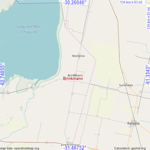
Brinkmann GPS coordinates[2]
30° 51' 57.204" South, 62° 2' 14.712" West
| Map corner | latitude | longitude |
|---|---|---|
| Upper-left | -30.26046°, | -62.74055° |
| Center: | -30.86589°, | -62.03742° |
| Lower-right: | -31.46752°, | -61.3343° |
| Map W x H: | 134.2×134.2 km | = 83.4×83.4mi |
| max Lat: | -21.94467° ⇑39.1% North |
| Brinkmann: | -30.86589° |
| min Lat: | ⇓60.9% South -54.81084° |
| min Long | Brinkmann | max Long |
| -72.88605° | -62.03742° | -53.64581° |
| W 55%⇐ | ⇒45% E |
Elevation
Elevation of Brinkmann is 105 m = 344 ft, and this is 244.3 m = 802 ft below average elevation for this country.
| Max E: |
4040 m = 13255 ft | 61% |
| Avg. | 349.3 m = 1146 ft | |
| Brinkmann | 105 m = 344 ft | |
Min E: |
-2 m = -7 ft | 39% |
See also: Argentina elevation on elevation.city.
Geographical zone
Brinkmann is located in South temperate zone (between Tropic of Capricorn and the Antarctic Circle). Distance of this Southern Tropic circle is 826 km =513.3 mi to North.| Distance of | km | miles | from Brinkmann |
|---|---|---|---|
| Equator | 3432 | 2132.5 | to North |
| Tropic Capricorn | 826 | 513.3 | to North |
| Antarctic Circle | 3969.2 | 2466.3 | to South |
| South Pole | 6575.1 | 4085.6 | to South |


Nearby cities:
15 places around Brinkmann: (largest is in red/bold)
• Altos de Chipión
30.3 km =18.8 mi,  250°
250°
• Arrufó
76.4 km =47.5 mi,  22°
22°
• Balnearia
62.1 km =38.6 mi,  255°
255°
• Bella Italia
75.5 km =46.9 mi,  127°
127°
• Devoto
65.1 km =40.5 mi,  203°
203°
• La Francia
82.7 km =51.4 mi,  223°
223°
• Marull
76.5 km =47.5 mi, 259°
• Miramar
61.4 km =38.2 mi, 264°
• Morteros
17.5 km =10.9 mi,  12°
12°
• Porteña
16.7 km =10.4 mi,  189°
189°
• Rafaela
67.7 km =42.1 mi, 129°
• San Francisco
62.6 km =38.9 mi,  183°
183°
• Sunchales
46.2 km =28.7 mi,  100°
100°
• Villa Concepción del Tío
89.7 km =55.7 mi,  235°
235°
• Villa Trinidad
74.2 km =46.1 mi, 12°
Sources, notices
• [Note1] Compared only with cities in Argentina existing in our database
• [Src1] Map data: © OpenStreetMap contributors (CC-BY-SA)
• [Src2] Other city data from geonames.org with taken over terms of usage.
• [Src3] Geographical zone / Annual Mean Temperature by Robert A. Rohde @ Wikipedia
