Wanzenöd geodata
Wanzenöd (Lower Austria) is a populated place; located in Austria in Europe/Vienna (GMT+2) time zone. With population of 748 people, there are 1729 cities with bigger population in this country. Compared to other cities in Austria, 69.8% of cities are located further ↓South; 53.7% of cities are located further →East and 58.5% of cities have higher elevation than Wanzenöd. Note1
Administrative division(s):
- Level 1: Lower Austria
- Level 2: Politischer Bezirk Amstetten
- Level 3: Behamberg


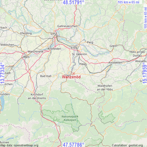
Wanzenöd GPS coordinates[2]
48° 3' 0.108" North, 14° 28' 35.256" East
| Map corner | latitude | longitude |
|---|---|---|
| Upper-left | 48.51791°, | 13.77334° |
| Center: | 48.05003°, | 14.47646° |
| Lower-right: | 47.57786°, | 15.17959° |
| Map W x H: | 104.5×104.5 km | = 64.9×64.9mi |
| max Lat: | 48.98333° ⇑30.2% North |
| Wanzenöd: | 48.05003° |
| min Lat: | ⇓69.8% South 46.48841° |
| min Long | Wanzenöd | max Long |
| 9.57802° | 14.47646° | 17.1° |
| W 46.3%⇐ | ⇒53.7% E |
Elevation
Elevation of Wanzenöd is 394 m = 1293 ft, and this is 111.5 m = 366 ft below average elevation for this country.
| Max E: |
2140 m = 7021 ft | 58.5% |
| Avg. | 505.5 m = 1658 ft | |
| Wanzenöd | 394 m = 1293 ft | |
Min E: |
118 m = 387 ft | 41.5% |
See also: Austria elevation on elevation.city.
Geographical zone
Wanzenöd is located in North temperate zone (between Tropic of Cancer and the Arctic Circle). Distance of this North polar circle is 2058.5 km =1279.1 mi to North.| Distance of | km | miles | from Wanzenöd |
|---|---|---|---|
| North Pole | 4664.4 | 2898.3 | to North |
| Arctic Circle | 2058.5 | 1279.1 | to North |
| Tropic Cancer | 2736.7 | 1700.5 | to South |
| Equator | 5342.7 | 3319.8 | to South |


Nearby cities:
15 places around Wanzenöd: (largest is in red/bold)
• Behamberg
3.7 km =2.3 mi,  172°
172°
• Dietach
6.3 km =3.9 mi,  315°
315°
• Dietachdorf
5.2 km =3.2 mi, 316°
• Ernsthofen
8.8 km =5.5 mi,  1°
1°
• Garsten
6 km =3.7 mi,  239°
239°
• Haidershofen
3.1 km =1.9 mi,  338°
338°
• Kleinraming
5.6 km =3.5 mi, 174°
• Kürnberg
7 km =4.3 mi,  142°
142°
• Lahrndorf
9.5 km =5.9 mi,  229°
229°
• Penz
1.9 km =1.2 mi,  164°
164°
• Sankt Ulrich bei Steyr
4.4 km =2.7 mi,  222°
222°
• Steyr
4.2 km =2.6 mi,  258°
258°
• Unterwald
3.8 km =2.4 mi,  191°
191°
• Weistrach
7.9 km =4.9 mi,  90°
90°
• Wolfern
8.6 km =5.3 mi,  295°
295°
Sources, notices
• [Note1] Compared only with cities in Austria existing in our database
• [Src1] Map data: © OpenStreetMap contributors (CC-BY-SA)
• [Src2] Other city data from geonames.org with taken over terms of usage.
• [Src3] Geographical zone / Annual Mean Temperature by Robert A. Rohde @ Wikipedia
