Kleinraming geodata
Kleinraming (Upper Austria) is a populated place; located in Austria in Europe/Vienna (GMT+2) time zone. With population of 548 people, there are 2329 cities with bigger population in this country. Compared to other cities in Austria, 66.1% of cities are located further ↓South; 53.6% of cities are located further →East and 63.8% of cities have lower elevation than Kleinraming. Note1
Administrative division(s):
- Level 1: Upper Austria
- Level 2: Politischer Bezirk Steyr-Land
- Level 3: Sankt Ulrich bei Steyr


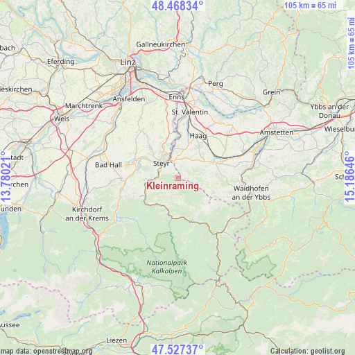
Kleinraming GPS coordinates[2]
48° 0' 0" North, 14° 28' 59.988" East
| Map corner | latitude | longitude |
|---|---|---|
| Upper-left | 48.46834°, | 13.78021° |
| Center: | 48°, | 14.48333° |
| Lower-right: | 47.52737°, | 15.18646° |
| Map W x H: | 104.6×104.6 km | = 65×65mi |
| max Lat: | 48.98333° ⇑33.9% North |
| Kleinraming: | 48° |
| min Lat: | ⇓66.1% South 46.48841° |
| min Long | Kleinraming | max Long |
| 9.57802° | 14.48333° | 17.1° |
| W 46.4%⇐ | ⇒53.6% E |
Elevation
Elevation of Kleinraming is 544 m = 1785 ft, and this is 38.5 m = 126 ft above average elevation for this country.
| Max E: |
2140 m = 7021 ft | 36.2% |
| Kleinraming | 544 m 1785 ft | |
| Avg. | 505.5 m = 1658 ft | |
Min E: |
118 m = 387 ft | 63.8% |
See also: Austria elevation on elevation.city.
Geographical zone
Kleinraming is located in North temperate zone (between Tropic of Cancer and the Arctic Circle). Distance of this North polar circle is 2064.1 km =1282.6 mi to North.| Distance of | km | miles | from Kleinraming |
|---|---|---|---|
| North Pole | 4670 | 2901.8 | to North |
| Arctic Circle | 2064.1 | 1282.6 | to North |
| Tropic Cancer | 2731.2 | 1697.1 | to South |
| Equator | 5337.1 | 3316.3 | to South |


Nearby cities:
15 places around Kleinraming: (largest is in red/bold)
• Behamberg
1.9 km =1.2 mi,  0°
0°
• Dietachdorf
10.1 km =6.3 mi,  336°
336°
• Garsten
6.2 km =3.9 mi,  293°
293°
• Haidershofen
8.6 km =5.3 mi,  349°
349°
• Kürnberg
3.7 km =2.3 mi,  90°
90°
• Lahrndorf
7.7 km =4.8 mi,  265°
265°
• Laussa
6.1 km =3.8 mi,  204°
204°
• Losenstein
9.1 km =5.7 mi, 202°
• Penz
3.7 km =2.3 mi, 0°
• Sankt Michael am Bruckbach
8.9 km =5.5 mi,  77°
77°
• Sankt Ulrich bei Steyr
4.2 km =2.6 mi,  304°
304°
• Steyr
6.6 km =4.1 mi,  315°
315°
• Unterwald
2.2 km =1.4 mi,  326°
326°
• Wanzenöd
5.6 km =3.5 mi, 354°
• Weistrach
9.3 km =5.8 mi,  53°
53°
Sources, notices
• [Note1] Compared only with cities in Austria existing in our database
• [Src1] Map data: © OpenStreetMap contributors (CC-BY-SA)
• [Src2] Other city data from geonames.org with taken over terms of usage.
• [Src3] Geographical zone / Annual Mean Temperature by Robert A. Rohde @ Wikipedia
