Weingraben geodata
Weingraben (Burgenland) is a seat of a third-order administrative division; located in Austria in Europe/Vienna (GMT+2) time zone. With population of 363 people, there are 2669 cities with bigger population in this country. Compared to other cities in Austria, 53.2% of cities are located further ↑North; 90.2% of cities are located further ←West and 56.5% of cities have higher elevation than Weingraben. Note1
Administrative division(s):
- Level 1: Burgenland
- Level 2: Politischer Bezirk Oberpullendorf
- Level 3: Weingraben


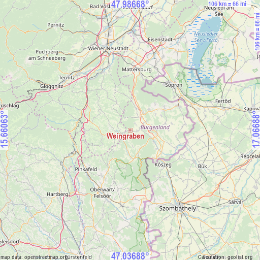
Weingraben GPS coordinates[2]
47° 30' 50.148" North, 16° 21' 49.5" East
| Map corner | latitude | longitude |
|---|---|---|
| Upper-left | 47.98668°, | 15.66063° |
| Center: | 47.51393°, | 16.36375° |
| Lower-right: | 47.03688°, | 17.06688° |
| Map W x H: | 105.6×105.6 km | = 65.6×65.6mi |
| max Lat: | 48.98333° ⇑53.2% North |
| Weingraben: | 47.51393° |
| min Lat: | ⇓46.8% South 46.48841° |
| min Long | Weingraben | max Long |
| 9.57802° | 16.36375° | 17.1° |
| W 90.2%⇐ | ⇒9.8% E |
Elevation
Elevation of Weingraben is 409 m = 1342 ft, and this is 96.5 m = 317 ft below average elevation for this country.
| Max E: |
2140 m = 7021 ft | 56.5% |
| Avg. | 505.5 m = 1658 ft | |
| Weingraben | 409 m = 1342 ft | |
Min E: |
118 m = 387 ft | 43.5% |
See also: Austria elevation on elevation.city.
Geographical zone
Weingraben is located in North temperate zone (between Tropic of Cancer and the Arctic Circle). Distance of this North polar circle is 2118.1 km =1316.1 mi to North.| Distance of | km | miles | from Weingraben |
|---|---|---|---|
| North Pole | 4724 | 2935.4 | to North |
| Arctic Circle | 2118.1 | 1316.1 | to North |
| Tropic Cancer | 2677.1 | 1663.5 | to South |
| Equator | 5283.1 | 3282.8 | to South |


Nearby cities:
15 places around Weingraben: (largest is in red/bold)
• Bad Schönau
10 km =6.2 mi,  257°
257°
• Drassmarkt
2.7 km =1.7 mi,  83°
83°
• Dörfl im Burgenland
9.6 km =6 mi,  110°
110°
• Kaisersdorf
3.4 km =2.1 mi,  39°
39°
• Kirchschlag in der Buckligen Welt
6.2 km =3.9 mi, 255°
• Kobersdorf
9.3 km =5.8 mi,  13°
13°
• Markt Sankt Martin
7.1 km =4.4 mi, 40°
• Neutal
7.1 km =4.4 mi,  60°
60°
• Oberpullendorf
10.6 km =6.6 mi,  96°
96°
• Pilgersdorf
8.2 km =5.1 mi,  187°
187°
• Piringsdorf
8.3 km =5.2 mi,  152°
152°
• Steinberg an der Rabnitz
10.3 km =6.4 mi,  115°
115°
• Stoob
8.7 km =5.4 mi, 79°
• Unterrabnitz
6.7 km =4.2 mi,  171°
171°
• Weppersdorf
8.7 km =5.4 mi,  32°
32°
Sources, notices
• [Note1] Compared only with cities in Austria existing in our database
• [Src1] Map data: © OpenStreetMap contributors (CC-BY-SA)
• [Src2] Other city data from geonames.org with taken over terms of usage.
• [Src3] Geographical zone / Annual Mean Temperature by Robert A. Rohde @ Wikipedia
