Unterrabnitz geodata
Unterrabnitz (Burgenland) is a populated place; located in Austria in Europe/Vienna (GMT+2) time zone. With population of 514 people, there are 2453 cities with bigger population in this country. Compared to other cities in Austria, 56.2% of cities are located further ↑North; 90.6% of cities are located further ←West and 70.5% of cities have higher elevation than Unterrabnitz. Note1
Administrative division(s):
- Level 1: Burgenland
- Level 2: Politischer Bezirk Oberpullendorf
- Level 3: Unterrabnitz-Schwendgraben


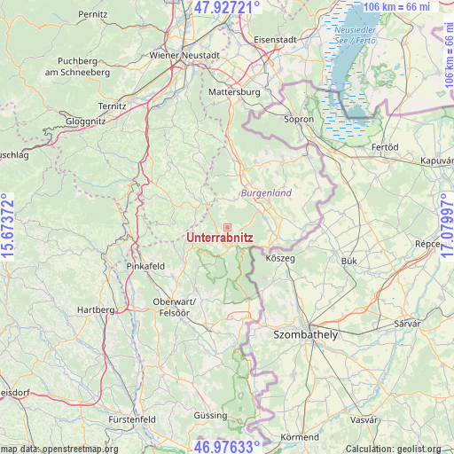
Unterrabnitz GPS coordinates[2]
47° 27' 14.112" North, 16° 22' 36.624" East
| Map corner | latitude | longitude |
|---|---|---|
| Upper-left | 47.92721°, | 15.67372° |
| Center: | 47.45392°, | 16.37684° |
| Lower-right: | 46.97633°, | 17.07997° |
| Map W x H: | 105.7×105.7 km | = 65.7×65.7mi |
| max Lat: | 48.98333° ⇑56.2% North |
| Unterrabnitz: | 47.45392° |
| min Lat: | ⇓43.8% South 46.48841° |
| min Long | Unterrabnitz | max Long |
| 9.57802° | 16.37684° | 17.1° |
| W 90.6%⇐ | ⇒9.4% E |
Elevation
Elevation of Unterrabnitz is 325 m = 1066 ft, and this is 180.5 m = 592 ft below average elevation for this country.
| Max E: |
2140 m = 7021 ft | 70.5% |
| Avg. | 505.5 m = 1658 ft | |
| Unterrabnitz | 325 m = 1066 ft | |
Min E: |
118 m = 387 ft | 29.5% |
See also: Austria elevation on elevation.city.
Geographical zone
Unterrabnitz is located in North temperate zone (between Tropic of Cancer and the Arctic Circle). Distance of this North polar circle is 2124.8 km =1320.3 mi to North.| Distance of | km | miles | from Unterrabnitz |
|---|---|---|---|
| North Pole | 4730.7 | 2939.5 | to North |
| Arctic Circle | 2124.8 | 1320.3 | to North |
| Tropic Cancer | 2670.5 | 1659.4 | to South |
| Equator | 5276.4 | 3278.6 | to South |


Nearby cities:
15 places around Unterrabnitz: (largest is in red/bold)
• Bernstein
11.3 km =7 mi,  237°
237°
• Drassmarkt
7.2 km =4.5 mi,  14°
14°
• Dörfl im Burgenland
8.6 km =5.3 mi,  67°
67°
• Kaisersdorf
9.4 km =5.8 mi, 6°
• Kirchschlag in der Buckligen Welt
8.7 km =5.4 mi,  306°
306°
• Lockenhaus
5.9 km =3.7 mi,  150°
150°
• Neutal
11.4 km =7.1 mi,  27°
27°
• Oberloisdorf
9.9 km =6.2 mi,  94°
94°
• Oberpullendorf
11.1 km =6.9 mi,  60°
60°
• Pilgersdorf
2.5 km =1.6 mi, 235°
• Piringsdorf
2.9 km =1.8 mi,  102°
102°
• Steinberg an der Rabnitz
8.6 km =5.3 mi, 74°
• Stoob
11.2 km =7 mi,  42°
42°
• Unterkohlstätten
9.1 km =5.7 mi,  209°
209°
• Weingraben
6.7 km =4.2 mi,  351°
351°
Sources, notices
• [Note1] Compared only with cities in Austria existing in our database
• [Src1] Map data: © OpenStreetMap contributors (CC-BY-SA)
• [Src2] Other city data from geonames.org with taken over terms of usage.
• [Src3] Geographical zone / Annual Mean Temperature by Robert A. Rohde @ Wikipedia
