Kaisersdorf geodata
Kaisersdorf (Burgenland) is a seat of a third-order administrative division; located in Austria in Europe/Vienna (GMT+2) time zone. With population of 620 people, there are 2065 cities with bigger population in this country. Compared to other cities in Austria, 51.9% of cities are located further ↑North; 91.1% of cities are located further ←West and 63.2% of cities have higher elevation than Kaisersdorf. Note1
Administrative division(s):
- Level 1: Burgenland
- Level 2: Politischer Bezirk Oberpullendorf
- Level 3: Kaisersdorf


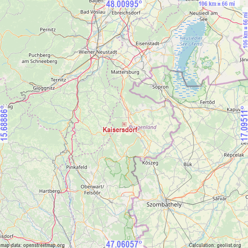
Kaisersdorf GPS coordinates[2]
47° 32' 14.676" North, 16° 23' 31.128" East
| Map corner | latitude | longitude |
|---|---|---|
| Upper-left | 48.00995°, | 15.68886° |
| Center: | 47.53741°, | 16.39198° |
| Lower-right: | 47.06057°, | 17.09511° |
| Map W x H: | 105.6×105.6 km | = 65.6×65.6mi |
| max Lat: | 48.98333° ⇑51.9% North |
| Kaisersdorf: | 47.53741° |
| min Lat: | ⇓48.1% South 46.48841° |
| min Long | Kaisersdorf | max Long |
| 9.57802° | 16.39198° | 17.1° |
| W 91.1%⇐ | ⇒8.9% E |
Elevation
Elevation of Kaisersdorf is 362 m = 1188 ft, and this is 143.5 m = 471 ft below average elevation for this country.
| Max E: |
2140 m = 7021 ft | 63.2% |
| Avg. | 505.5 m = 1658 ft | |
| Kaisersdorf | 362 m = 1188 ft | |
Min E: |
118 m = 387 ft | 36.8% |
See also: Austria elevation on elevation.city.
Geographical zone
Kaisersdorf is located in North temperate zone (between Tropic of Cancer and the Arctic Circle). Distance of this North polar circle is 2115.5 km =1314.5 mi to North.| Distance of | km | miles | from Kaisersdorf |
|---|---|---|---|
| North Pole | 4721.4 | 2933.7 | to North |
| Arctic Circle | 2115.5 | 1314.5 | to North |
| Tropic Cancer | 2679.7 | 1665.1 | to South |
| Equator | 5285.7 | 3284.4 | to South |


Nearby cities:
15 places around Kaisersdorf: (largest is in red/bold)
• Drassmarkt
2.4 km =1.5 mi,  165°
165°
• Dörfl im Burgenland
9.1 km =5.7 mi,  131°
131°
• Kirchschlag in der Buckligen Welt
9.2 km =5.7 mi,  242°
242°
• Kobersdorf
6.5 km =4 mi,  359°
359°
• Lackenbach
8.1 km =5 mi,  43°
43°
• Markt Sankt Martin
3.7 km =2.3 mi, 42°
• Neutal
4.2 km =2.6 mi,  77°
77°
• Oberpetersdorf
8.8 km =5.5 mi,  352°
352°
• Oberpullendorf
9.2 km =5.7 mi,  114°
114°
• Stoob
6.5 km =4 mi,  98°
98°
• Tschurndorf
7.9 km =4.9 mi,  7°
7°
• Unterfrauenhaid
8.9 km =5.5 mi,  64°
64°
• Unterrabnitz
9.4 km =5.8 mi,  186°
186°
• Weingraben
3.4 km =2.1 mi,  219°
219°
• Weppersdorf
5.4 km =3.4 mi,  29°
29°
Sources, notices
• [Note1] Compared only with cities in Austria existing in our database
• [Src1] Map data: © OpenStreetMap contributors (CC-BY-SA)
• [Src2] Other city data from geonames.org with taken over terms of usage.
• [Src3] Geographical zone / Annual Mean Temperature by Robert A. Rohde @ Wikipedia
