Weppersdorf geodata
Weppersdorf (Burgenland) is a seat of a third-order administrative division; located in Austria in Europe/Vienna (GMT+2) time zone. With population of 976 people, there are 1328 cities with bigger population in this country. Compared to other cities in Austria, 50.5% of cities are located further ↑North; 92.1% of cities are located further ←West and 75.4% of cities have higher elevation than Weppersdorf. Note1
Administrative division(s):
- Level 1: Burgenland
- Level 2: Politischer Bezirk Oberpullendorf
- Level 3: Weppersdorf


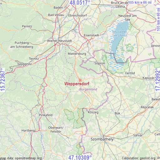
Weppersdorf GPS coordinates[2]
47° 34' 46.344" North, 16° 25' 36.444" East
| Map corner | latitude | longitude |
|---|---|---|
| Upper-left | 48.0517°, | 15.72367° |
| Center: | 47.57954°, | 16.42679° |
| Lower-right: | 47.10309°, | 17.12992° |
| Map W x H: | 105.5×105.5 km | = 65.6×65.6mi |
| max Lat: | 48.98333° ⇑50.5% North |
| Weppersdorf: | 47.57954° |
| min Lat: | ⇓49.5% South 46.48841° |
| min Long | Weppersdorf | max Long |
| 9.57802° | 16.42679° | 17.1° |
| W 92.1%⇐ | ⇒7.9% E |
Elevation
Elevation of Weppersdorf is 300 m = 984 ft, and this is 205.5 m = 674 ft below average elevation for this country.
| Max E: |
2140 m = 7021 ft | 75.4% |
| Avg. | 505.5 m = 1658 ft | |
| Weppersdorf | 300 m = 984 ft | |
Min E: |
118 m = 387 ft | 24.6% |
See also: Austria elevation on elevation.city.
Geographical zone
Weppersdorf is located in North temperate zone (between Tropic of Cancer and the Arctic Circle). Distance of this North polar circle is 2110.8 km =1311.6 mi to North.| Distance of | km | miles | from Weppersdorf |
|---|---|---|---|
| North Pole | 4716.7 | 2930.8 | to North |
| Arctic Circle | 2110.8 | 1311.6 | to North |
| Tropic Cancer | 2684.4 | 1668 | to South |
| Equator | 5290.3 | 3287.2 | to South |


Nearby cities:
15 places around Weppersdorf: (largest is in red/bold)
• Drassmarkt
7.3 km =4.5 mi,  196°
196°
• Kaisersdorf
5.4 km =3.4 mi,  209°
209°
• Kobersdorf
3.2 km =2 mi,  304°
304°
• Lackenbach
3.1 km =1.9 mi,  67°
67°
• Lackendorf
5.9 km =3.7 mi,  78°
78°
• Markt Sankt Martin
1.9 km =1.2 mi,  183°
183°
• Neutal
4.1 km =2.5 mi,  158°
158°
• Oberpetersdorf
5.5 km =3.4 mi,  316°
316°
• Raiding
7.9 km =4.9 mi,  101°
101°
• Ritzing
6.4 km =4 mi,  54°
54°
• Schwarzenbach
8.4 km =5.2 mi, 317°
• Stoob
6.8 km =4.2 mi,  146°
146°
• Tschurndorf
3.5 km =2.2 mi,  333°
333°
• Unterfrauenhaid
5.5 km =3.4 mi, 99°
• Weingraben
8.7 km =5.4 mi, 212°
Sources, notices
• [Note1] Compared only with cities in Austria existing in our database
• [Src1] Map data: © OpenStreetMap contributors (CC-BY-SA)
• [Src2] Other city data from geonames.org with taken over terms of usage.
• [Src3] Geographical zone / Annual Mean Temperature by Robert A. Rohde @ Wikipedia
