Hirm geodata
Hirm (Burgenland) is a seat of a third-order administrative division; located in Austria in Europe/Vienna (GMT+2) time zone. With population of 1,009 people, there are 1278 cities with bigger population in this country. Compared to other cities in Austria, 56.7% of cities are located further ↓South; 92.7% of cities are located further ←West and 94.8% of cities have higher elevation than Hirm. Note1
Administrative division(s):
- Level 1: Burgenland
- Level 2: Politischer Bezirk Mattersburg
- Level 3: Hirm


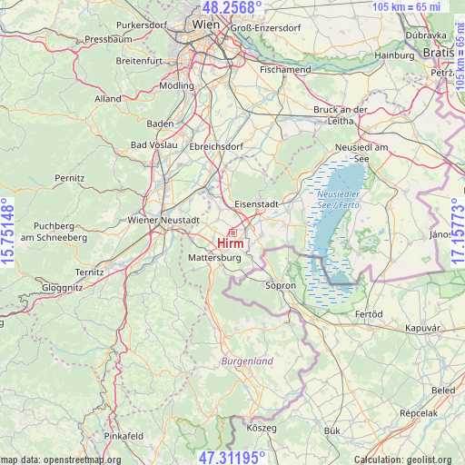
Hirm GPS coordinates[2]
47° 47' 11.472" North, 16° 27' 16.56" East
| Map corner | latitude | longitude |
|---|---|---|
| Upper-left | 48.2568°, | 15.75148° |
| Center: | 47.78652°, | 16.4546° |
| Lower-right: | 47.31195°, | 17.15773° |
| Map W x H: | 105.1×105.1 km | = 65.3×65.3mi |
| max Lat: | 48.98333° ⇑43.3% North |
| Hirm: | 47.78652° |
| min Lat: | ⇓56.7% South 46.48841° |
| min Long | Hirm | max Long |
| 9.57802° | 16.4546° | 17.1° |
| W 92.7%⇐ | ⇒7.3% E |
Elevation
Elevation of Hirm is 180 m = 591 ft, and this is 325.5 m = 1068 ft below average elevation for this country.
| Max E: |
2140 m = 7021 ft | 94.8% |
| Avg. | 505.5 m = 1658 ft | |
| Hirm | 180 m = 591 ft | |
Min E: |
118 m = 387 ft | 5.2% |
See also: Austria elevation on elevation.city.
Geographical zone
Hirm is located in North temperate zone (between Tropic of Cancer and the Arctic Circle). Distance of this North polar circle is 2087.8 km =1297.3 mi to North.| Distance of | km | miles | from Hirm |
|---|---|---|---|
| North Pole | 4693.7 | 2916.5 | to North |
| Arctic Circle | 2087.8 | 1297.3 | to North |
| Tropic Cancer | 2707.4 | 1682.3 | to South |
| Equator | 5313.4 | 3301.6 | to South |


Nearby cities:
15 places around Hirm: (largest is in red/bold)
• Antau
2.4 km =1.5 mi,  126°
126°
• Baumgarten im Burgenland
6.3 km =3.9 mi,  146°
146°
• Drassburg
5.1 km =3.2 mi, 151°
• Grosshöflein
5.8 km =3.6 mi,  19°
19°
• Krensdorf
3 km =1.9 mi,  267°
267°
• Müllendorf
5.9 km =3.7 mi,  5°
5°
• Pöttelsdorf
3.8 km =2.4 mi,  198°
198°
• Sigless
4.6 km =2.9 mi,  254°
254°
• Steinbrunn
5.9 km =3.7 mi,  331°
331°
• Stöttera
2.1 km =1.3 mi,  166°
166°
• Walbersdorf
5.6 km =3.5 mi,  207°
207°
• Wulkaprodersdorf
3.9 km =2.4 mi,  71°
71°
• Zagersdorf
5 km =3.1 mi,  118°
118°
• Zemendorf
2.7 km =1.7 mi,  185°
185°
• Zillingtal
4.6 km =2.9 mi,  312°
312°
Sources, notices
• [Note1] Compared only with cities in Austria existing in our database
• [Src1] Map data: © OpenStreetMap contributors (CC-BY-SA)
• [Src2] Other city data from geonames.org with taken over terms of usage.
• [Src3] Geographical zone / Annual Mean Temperature by Robert A. Rohde @ Wikipedia
