Vorderhornbach geodata
Vorderhornbach (Tyrol) is a seat of a third-order administrative division; located in Austria in Europe/Vienna (GMT+2) time zone. With population of 245 people, there are 2814 cities with bigger population in this country. Compared to other cities in Austria, 61.4% of cities are located further ↑North; 95.8% of cities are located further →East and 93.7% of cities have lower elevation than Vorderhornbach. Note1
Administrative division(s):
- Level 1: Tyrol
- Level 2: Politischer Bezirk Reutte
- Level 3: Vorderhornbach


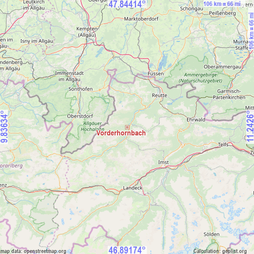
Vorderhornbach GPS coordinates[2]
47° 22' 12.324" North, 10° 32' 22.092" East
| Map corner | latitude | longitude |
|---|---|---|
| Upper-left | 47.84414°, | 9.83634° |
| Center: | 47.37009°, | 10.53947° |
| Lower-right: | 46.89174°, | 11.2426° |
| Map W x H: | 105.9×105.9 km | = 65.8×65.8mi |
| max Lat: | 48.98333° ⇑61.4% North |
| Vorderhornbach: | 47.37009° |
| min Lat: | ⇓38.6% South 46.48841° |
| min Long | Vorderhornbach | max Long |
| 9.57802° | 10.53947° | 17.1° |
| W 4.2%⇐ | ⇒95.8% E |
Elevation
Elevation of Vorderhornbach is 976 m = 3202 ft, and this is 470.5 m = 1544 ft above average elevation for this country.
| Max E: |
2140 m = 7021 ft | 6.3% |
| Vorderhornbach | 976 m 3202 ft | |
| Avg. | 505.5 m = 1658 ft | |
Min E: |
118 m = 387 ft | 93.7% |
See also: Austria elevation on elevation.city.
Geographical zone
Vorderhornbach is located in North temperate zone (between Tropic of Cancer and the Arctic Circle). Distance of this North polar circle is 2134.1 km =1326.1 mi to North.| Distance of | km | miles | from Vorderhornbach |
|---|---|---|---|
| North Pole | 4740 | 2945.3 | to North |
| Arctic Circle | 2134.1 | 1326.1 | to North |
| Tropic Cancer | 2661.1 | 1653.5 | to South |
| Equator | 5267.1 | 3272.8 | to South |


Nearby cities:
15 places around Vorderhornbach: (largest is in red/bold)
• Berwang
16.2 km =10.1 mi,  74°
74°
• Ehenbichl
16.2 km =10.1 mi,  48°
48°
• Elbigenalp
11.8 km =7.3 mi,  221°
221°
• Elmen
3.3 km =2.1 mi,  175°
175°
• Forchach
6.1 km =3.8 mi,  32°
32°
• Gramais
11.5 km =7.1 mi, 182°
• Grän
14.5 km =9 mi,  3°
3°
• Häselgehr
6.6 km =4.1 mi,  206°
206°
• Höfen
15.2 km =9.4 mi, 45°
• Namlos
9.8 km =6.1 mi,  103°
103°
• Nesselwängle
13.9 km =8.6 mi,  24°
24°
• Stanzach
2.5 km =1.6 mi, 54°
• Tannheim
14.5 km =9 mi,  353°
353°
• Weissenbach am Lech
11 km =6.8 mi,  43°
43°
• Zöblen
15.9 km =9.9 mi,  343°
343°
Sources, notices
• [Note1] Compared only with cities in Austria existing in our database
• [Src1] Map data: © OpenStreetMap contributors (CC-BY-SA)
• [Src2] Other city data from geonames.org with taken over terms of usage.
• [Src3] Geographical zone / Annual Mean Temperature by Robert A. Rohde @ Wikipedia
