Perlsdorf geodata
Perlsdorf (Styria) is a seat of a third-order administrative division; located in Austria in Europe/Vienna (GMT+2) time zone. With population of 337 people, there are 2699 cities with bigger population in this country. Compared to other cities in Austria, 87.7% of cities are located further ↑North; 75.1% of cities are located further ←West and 74.6% of cities have higher elevation than Perlsdorf. Note1
Administrative division(s):
- Level 1: Styria
- Level 2: Politischer Bezirk Südoststeiermark
- Level 3: Paldau


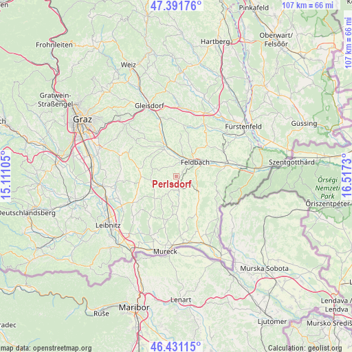
Perlsdorf GPS coordinates[2]
46° 54' 48.996" North, 15° 48' 51.012" East
| Map corner | latitude | longitude |
|---|---|---|
| Upper-left | 47.39176°, | 15.11105° |
| Center: | 46.91361°, | 15.81417° |
| Lower-right: | 46.43115°, | 16.5173° |
| Map W x H: | 106.8×106.8 km | = 66.4×66.4mi |
| max Lat: | 48.98333° ⇑87.7% North |
| Perlsdorf: | 46.91361° |
| min Lat: | ⇓12.3% South 46.48841° |
| min Long | Perlsdorf | max Long |
| 9.57802° | 15.81417° | 17.1° |
| W 75.1%⇐ | ⇒24.9% E |
Elevation
Elevation of Perlsdorf is 306 m = 1004 ft, and this is 199.5 m = 655 ft below average elevation for this country.
| Max E: |
2140 m = 7021 ft | 74.6% |
| Avg. | 505.5 m = 1658 ft | |
| Perlsdorf | 306 m = 1004 ft | |
Min E: |
118 m = 387 ft | 25.4% |
See also: Austria elevation on elevation.city.
Geographical zone
Perlsdorf is located in North temperate zone (between Tropic of Cancer and the Arctic Circle). Distance of this North polar circle is 2184.9 km =1357.6 mi to North.| Distance of | km | miles | from Perlsdorf |
|---|---|---|---|
| North Pole | 4790.8 | 2976.9 | to North |
| Arctic Circle | 2184.9 | 1357.6 | to North |
| Tropic Cancer | 2610.4 | 1622 | to South |
| Equator | 5216.3 | 3241.3 | to South |


Nearby cities:
15 places around Perlsdorf: (largest is in red/bold)
• Baumgarten bei Gnas
3.6 km =2.2 mi,  275°
275°
• Burgfried
4.1 km =2.5 mi,  158°
158°
• Feldbach
7.1 km =4.4 mi,  52°
52°
• Gnas
4.6 km =2.9 mi,  169°
169°
• Gniebing
6.3 km =3.9 mi,  30°
30°
• Kohlberg
2.8 km =1.7 mi,  237°
237°
• Maierdorf
3.6 km =2.2 mi,  130°
130°
• Oberstorcha
6 km =3.7 mi,  349°
349°
• Oedt bei Feldbach
4.6 km =2.9 mi,  56°
56°
• Paldau
3.5 km =2.2 mi,  336°
336°
• Raning
7.1 km =4.4 mi,  178°
178°
• Trautmannsdorf in Oststeiermark
6.8 km =4.2 mi, 128°
• Unterauersbach
6.3 km =3.9 mi,  211°
211°
• Unterweissenbach
4.9 km =3 mi, 33°
• Wörth bei Kirchberg an der Raab
6.9 km =4.3 mi,  328°
328°
Sources, notices
• [Note1] Compared only with cities in Austria existing in our database
• [Src1] Map data: © OpenStreetMap contributors (CC-BY-SA)
• [Src2] Other city data from geonames.org with taken over terms of usage.
• [Src3] Geographical zone / Annual Mean Temperature by Robert A. Rohde @ Wikipedia
