Steyrling geodata
Steyrling (Upper Austria) is a populated place; located in Austria in Europe/Vienna (GMT+2) time zone. With population of 574 people, there are 2230 cities with bigger population in this country. Compared to other cities in Austria, 57.3% of cities are located further ↓South; 61.9% of cities are located further →East and 60% of cities have lower elevation than Steyrling. Note1
Administrative division(s):
- Level 1: Upper Austria
- Level 2: Politischer Bezirk Kirchdorf an der Krems
- Level 3: Klaus an der Pyhrnbahn


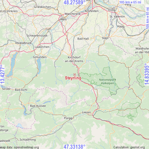
Steyrling GPS coordinates[2]
47° 48' 20.808" North, 14° 7' 50.952" East
| Map corner | latitude | longitude |
|---|---|---|
| Upper-left | 48.27589°, | 13.4277° |
| Center: | 47.80578°, | 14.13082° |
| Lower-right: | 47.33138°, | 14.83395° |
| Map W x H: | 105×105 km | = 65.2×65.2mi |
| max Lat: | 48.98333° ⇑42.7% North |
| Steyrling: | 47.80578° |
| min Lat: | ⇓57.3% South 46.48841° |
| min Long | Steyrling | max Long |
| 9.57802° | 14.13082° | 17.1° |
| W 38.1%⇐ | ⇒61.9% E |
Elevation
Elevation of Steyrling is 517 m = 1696 ft, and this is 11.5 m = 38 ft above average elevation for this country.
| Max E: |
2140 m = 7021 ft | 40% |
| Steyrling | 517 m 1696 ft | |
| Avg. | 505.5 m = 1658 ft | |
Min E: |
118 m = 387 ft | 60% |
See also: Austria elevation on elevation.city.
Geographical zone
Steyrling is located in North temperate zone (between Tropic of Cancer and the Arctic Circle). Distance of this North polar circle is 2085.7 km =1296 mi to North.| Distance of | km | miles | from Steyrling |
|---|---|---|---|
| North Pole | 4691.6 | 2915.2 | to North |
| Arctic Circle | 2085.7 | 1296 | to North |
| Tropic Cancer | 2709.6 | 1683.7 | to South |
| Equator | 5315.5 | 3302.9 | to South |


Nearby cities:
15 places around Steyrling: (largest is in red/bold)
• Grünau im Almtal
14.2 km =8.8 mi,  292°
292°
• Hausmanning
11.9 km =7.4 mi,  357°
357°
• Inzersdorf im Kremstal
14.1 km =8.8 mi,  344°
344°
• Kirchdorf an der Krems
11.1 km =6.9 mi, 356°
• Leonstein
12.6 km =7.8 mi,  36°
36°
• Micheldorf in Oberösterreich
8 km =5 mi,  1°
1°
• Molln
13.1 km =8.1 mi,  46°
46°
• Mühldorf
16.8 km =10.4 mi,  306°
306°
• Ramsau
10.5 km =6.5 mi,  68°
68°
• Scharnstein
16.7 km =10.4 mi, 310°
• Schlierbach
14.5 km =9 mi, 356°
• Schweizersberg
15.1 km =9.4 mi,  131°
131°
• Steinbach am Ziehberg
12.2 km =7.6 mi,  322°
322°
• Viechtwang
17.4 km =10.8 mi, 314°
• Windischgarsten
17.4 km =10.8 mi,  122°
122°
Sources, notices
• [Note1] Compared only with cities in Austria existing in our database
• [Src1] Map data: © OpenStreetMap contributors (CC-BY-SA)
• [Src2] Other city data from geonames.org with taken over terms of usage.
• [Src3] Geographical zone / Annual Mean Temperature by Robert A. Rohde @ Wikipedia
