Schwertberg geodata
Schwertberg (Upper Austria) is a seat of a third-order administrative division; located in Austria in Europe/Vienna (GMT+2) time zone. With population of 3,895 people, there are 269 cities with bigger population in this country. Compared to other cities in Austria, 84.2% of cities are located further ↓South; 51.8% of cities are located further →East and 82.1% of cities have higher elevation than Schwertberg. Note1
Administrative division(s):
- Level 1: Upper Austria
- Level 2: Politischer Bezirk Perg
- Level 3: Schwertberg


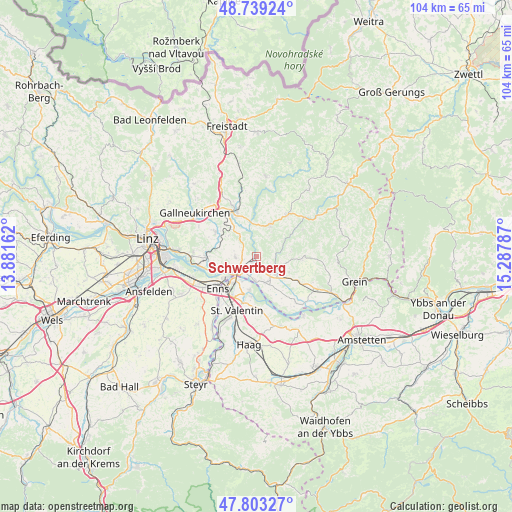
Schwertberg GPS coordinates[2]
48° 16' 24.24" North, 14° 35' 5.064" East
| Map corner | latitude | longitude |
|---|---|---|
| Upper-left | 48.73924°, | 13.88162° |
| Center: | 48.2734°, | 14.58474° |
| Lower-right: | 47.80327°, | 15.28787° |
| Map W x H: | 104.1×104.1 km | = 64.7×64.7mi |
| max Lat: | 48.98333° ⇑15.8% North |
| Schwertberg: | 48.2734° |
| min Lat: | ⇓84.2% South 46.48841° |
| min Long | Schwertberg | max Long |
| 9.57802° | 14.58474° | 17.1° |
| W 48.2%⇐ | ⇒51.8% E |
Elevation
Elevation of Schwertberg is 264 m = 866 ft, and this is 241.5 m = 792 ft below average elevation for this country.
| Max E: |
2140 m = 7021 ft | 82.1% |
| Avg. | 505.5 m = 1658 ft | |
| Schwertberg | 264 m = 866 ft | |
Min E: |
118 m = 387 ft | 17.9% |
See also: Austria elevation on elevation.city.
Geographical zone
Schwertberg is located in North temperate zone (between Tropic of Cancer and the Arctic Circle). Distance of this North polar circle is 2033.7 km =1263.7 mi to North.| Distance of | km | miles | from Schwertberg |
|---|---|---|---|
| North Pole | 4639.6 | 2882.9 | to North |
| Arctic Circle | 2033.7 | 1263.7 | to North |
| Tropic Cancer | 2761.6 | 1716 | to South |
| Equator | 5367.5 | 3335.2 | to South |


Nearby cities:
15 places around Schwertberg: (largest is in red/bold)
• Allerheiligen im Mühlkreis
5.8 km =3.6 mi,  56°
56°
• Au an der Donau
5 km =3.1 mi,  181°
181°
• Blindendorf
7.1 km =4.4 mi,  270°
270°
• Doppl
1.6 km =1 mi,  309°
309°
• Heinrichsbrunn
5 km =3.1 mi,  227°
227°
• Loitzenberg
2.4 km =1.5 mi, 268°
• Mauthausen
6 km =3.7 mi, 233°
• Naarn im Machlande
5.6 km =3.5 mi,  161°
161°
• Perg
4.4 km =2.7 mi,  125°
125°
• Ried in der Riedmark
4.2 km =2.6 mi, 266°
• Sankt Pantaleon
7.1 km =4.4 mi,  190°
190°
• Tragwein
7.2 km =4.5 mi,  22°
22°
• Ufer
6.9 km =4.3 mi,  246°
246°
• Unterjosefstal
2.2 km =1.4 mi,  341°
341°
• Wasserburg
1.7 km =1.1 mi, 273°
Sources, notices
• [Note1] Compared only with cities in Austria existing in our database
• [Src1] Map data: © OpenStreetMap contributors (CC-BY-SA)
• [Src2] Other city data from geonames.org with taken over terms of usage.
• [Src3] Geographical zone / Annual Mean Temperature by Robert A. Rohde @ Wikipedia
