Allerheiligen im Mühlkreis geodata
Allerheiligen im Mühlkreis (Upper Austria) is a seat of a third-order administrative division; located in Austria in Europe/Vienna (GMT+2) time zone. With population of 371 people, there are 2656 cities with bigger population in this country. Compared to other cities in Austria, 85.9% of cities are located further ↓South; 50.9% of cities are located further →East and 65% of cities have lower elevation than Allerheiligen im Mühlkreis. Note1
Administrative division(s):
- Level 1: Upper Austria
- Level 2: Politischer Bezirk Perg
- Level 3: Allerheiligen im Mühlkreis
Current local time in Allerheiligen im Mühlkreis:
11:53 PM, FridayDifference from your time zone: hours


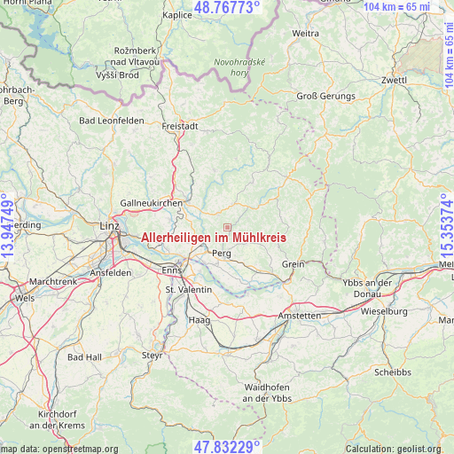
Allerheiligen im Mühlkreis GPS coordinates[2]
48° 18' 7.74" North, 14° 39' 2.196" East
| Map corner | latitude | longitude |
|---|---|---|
| Upper-left | 48.76773°, | 13.94749° |
| Center: | 48.30215°, | 14.65061° |
| Lower-right: | 47.83229°, | 15.35374° |
| Map W x H: | 104×104 km | = 64.6×64.6mi |
| max Lat: | 48.98333° ⇑14.1% North |
| Allerheiligen im Mühlkreis: | 48.30215° |
| min Lat: | ⇓85.9% South 46.48841° |
| min Long | Allerheiligen i | max Long |
| 9.57802° | 14.65061° | 17.1° |
| W 49.1%⇐ | ⇒50.9% E |
Elevation
Elevation of Allerheiligen im Mühlkreis is 553 m = 1814 ft, and this is 47.5 m = 156 ft above average elevation for this country.
| Max E: |
2140 m = 7021 ft | 35% |
| Allerheiligen im Mühlkreis | 553 m 1814 ft | |
| Avg. | 505.5 m = 1658 ft | |
Min E: |
118 m = 387 ft | 65% |
See also: Austria elevation on elevation.city.
Geographical zone
Allerheiligen im Mühlkreis is located in North temperate zone (between Tropic of Cancer and the Arctic Circle). Distance of this North polar circle is 2030.5 km =1261.7 mi to North.| Distance of | km | miles | from Allerheiligen im Mühlkreis |
|---|---|---|---|
| North Pole | 4636.4 | 2880.9 | to North |
| Arctic Circle | 2030.5 | 1261.7 | to North |
| Tropic Cancer | 2764.8 | 1718 | to South |
| Equator | 5370.7 | 3337.2 | to South |


Nearby cities:
15 places around Allerheiligen im Mühlkreis: (largest is in red/bold)
• Arbing
9 km =5.6 mi,  154°
154°
• Au an der Donau
9.6 km =6 mi,  211°
211°
• Bad Zell
5.4 km =3.4 mi,  14°
14°
• Doppl
6.5 km =4 mi,  250°
250°
• Loitzenberg
7.9 km =4.9 mi, 245°
• Münzbach
5.9 km =3.7 mi,  131°
131°
• Naarn im Machlande
9.1 km =5.7 mi,  200°
200°
• Perg
5.9 km =3.7 mi,  192°
192°
• Pierbach
9.3 km =5.8 mi,  56°
56°
• Ried in der Riedmark
9.7 km =6 mi, 249°
• Schwertberg
5.8 km =3.6 mi,  236°
236°
• Tragwein
4 km =2.5 mi,  328°
328°
• Unterjosefstal
5.7 km =3.5 mi,  258°
258°
• Wasserburg
7.3 km =4.5 mi, 244°
• Windhaag bei Perg
2.9 km =1.8 mi, 129°
Sources, notices
• [Note1] Compared only with cities in Austria existing in our database
• [Src1] Map data: © OpenStreetMap contributors (CC-BY-SA)
• [Src2] Other city data from geonames.org with taken over terms of usage.
• [Src3] Geographical zone / Annual Mean Temperature by Robert A. Rohde @ Wikipedia
