Schöngrabern geodata
Schöngrabern (Lower Austria) is a populated place; located in Austria in Europe/Vienna (GMT+2) time zone. With population of 981 people, there are 1321 cities with bigger population in this country. Compared to other cities in Austria, 96.6% of cities are located further ↓South; 81.5% of cities are located further ←West and 83.6% of cities have higher elevation than Schöngrabern. Note1
Administrative division(s):
- Level 1: Lower Austria
- Level 2: Politischer Bezirk Hollabrunn
- Level 3: Grabern


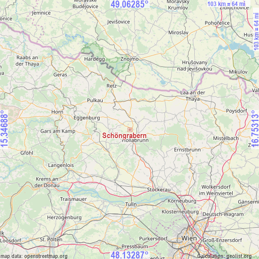
Schöngrabern GPS coordinates[2]
48° 36' 0" North, 16° 3' 0" East
| Map corner | latitude | longitude |
|---|---|---|
| Upper-left | 49.06285°, | 15.34688° |
| Center: | 48.6°, | 16.05° |
| Lower-right: | 48.13287°, | 16.75313° |
| Map W x H: | 103.4×103.4 km | = 64.2×64.2mi |
| max Lat: | 48.98333° ⇑3.4% North |
| Schöngrabern: | 48.6° |
| min Lat: | ⇓96.6% South 46.48841° |
| min Long | Schöngrabern | max Long |
| 9.57802° | 16.05° | 17.1° |
| W 81.5%⇐ | ⇒18.5% E |
Elevation
Elevation of Schöngrabern is 255 m = 837 ft, and this is 250.5 m = 822 ft below average elevation for this country.
| Max E: |
2140 m = 7021 ft | 83.6% |
| Avg. | 505.5 m = 1658 ft | |
| Schöngrabern | 255 m = 837 ft | |
Min E: |
118 m = 387 ft | 16.4% |
See also: Austria elevation on elevation.city.
Geographical zone
Schöngrabern is located in North temperate zone (between Tropic of Cancer and the Arctic Circle). Distance of this North polar circle is 1997.4 km =1241.1 mi to North.| Distance of | km | miles | from Schöngrabern |
|---|---|---|---|
| North Pole | 4603.2 | 2860.3 | to North |
| Arctic Circle | 1997.4 | 1241.1 | to North |
| Tropic Cancer | 2797.9 | 1738.5 | to South |
| Equator | 5403.8 | 3357.8 | to South |


Nearby cities:
15 places around Schöngrabern: (largest is in red/bold)
• Alberndorf
11.7 km =7.3 mi,  18°
18°
• Breitenwaida
11.2 km =7 mi,  173°
173°
• Guntersdorf
5.6 km =3.5 mi,  0°
0°
• Göllersdorf
12.9 km =8 mi,  156°
156°
• Hadres
13.5 km =8.4 mi,  25°
25°
• Haugsdorf
12.1 km =7.5 mi,  9°
9°
• Hollabrunn
6.1 km =3.8 mi, 156°
• Mailberg
12.7 km =7.9 mi,  49°
49°
• Obritz
13.3 km =8.3 mi, 33°
• Pernersdorf
11.4 km =7.1 mi,  347°
347°
• Sitzendorf an der Schmida
7.9 km =4.9 mi,  268°
268°
• Sonnberg
7.4 km =4.6 mi,  180°
180°
• Wullersdorf
4.9 km =3 mi, 50°
• Zellerndorf
12.7 km =7.9 mi,  327°
327°
• Ziersdorf
11.9 km =7.4 mi,  229°
229°
Sources, notices
• [Note1] Compared only with cities in Austria existing in our database
• [Src1] Map data: © OpenStreetMap contributors (CC-BY-SA)
• [Src2] Other city data from geonames.org with taken over terms of usage.
• [Src3] Geographical zone / Annual Mean Temperature by Robert A. Rohde @ Wikipedia
