Wullersdorf geodata
Wullersdorf (Lower Austria) is a seat of a third-order administrative division; located in Austria in Europe/Vienna (GMT+2) time zone. With population of 737 people, there are 1758 cities with bigger population in this country. Compared to other cities in Austria, 97% of cities are located further ↓South; 83.2% of cities are located further ←West and 87.8% of cities have higher elevation than Wullersdorf. Note1
Administrative division(s):
- Level 1: Lower Austria
- Level 2: Politischer Bezirk Hollabrunn
- Level 3: Wullersdorf


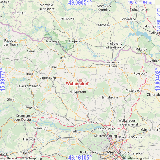
Wullersdorf GPS coordinates[2]
48° 37' 40.512" North, 16° 6' 3.204" East
| Map corner | latitude | longitude |
|---|---|---|
| Upper-left | 49.09051°, | 15.39777° |
| Center: | 48.62792°, | 16.10089° |
| Lower-right: | 48.16105°, | 16.80402° |
| Map W x H: | 103.3×103.3 km | = 64.2×64.2mi |
| max Lat: | 48.98333° ⇑3% North |
| Wullersdorf: | 48.62792° |
| min Lat: | ⇓97% South 46.48841° |
| min Long | Wullersdorf | max Long |
| 9.57802° | 16.10089° | 17.1° |
| W 83.2%⇐ | ⇒16.8% E |
Elevation
Elevation of Wullersdorf is 230 m = 755 ft, and this is 275.5 m = 904 ft below average elevation for this country.
| Max E: |
2140 m = 7021 ft | 87.8% |
| Avg. | 505.5 m = 1658 ft | |
| Wullersdorf | 230 m = 755 ft | |
Min E: |
118 m = 387 ft | 12.2% |
See also: Austria elevation on elevation.city.
Geographical zone
Wullersdorf is located in North temperate zone (between Tropic of Cancer and the Arctic Circle). Distance of this North polar circle is 1994.3 km =1239.2 mi to North.| Distance of | km | miles | from Wullersdorf |
|---|---|---|---|
| North Pole | 4600.1 | 2858.4 | to North |
| Arctic Circle | 1994.3 | 1239.2 | to North |
| Tropic Cancer | 2801 | 1740.5 | to South |
| Equator | 5406.9 | 3359.7 | to South |


Nearby cities:
15 places around Wullersdorf: (largest is in red/bold)
• Alberndorf
8 km =5 mi,  359°
359°
• Breitenwaida
14.4 km =8.9 mi,  190°
190°
• Großharras
11.4 km =7.1 mi,  69°
69°
• Großkadolz
11.3 km =7 mi,  33°
33°
• Guntersdorf
4.5 km =2.8 mi,  303°
303°
• Hadres
9.3 km =5.8 mi,  13°
13°
• Haugsdorf
9 km =5.6 mi,  348°
348°
• Hollabrunn
8.8 km =5.5 mi, 188°
• Mailberg
7.8 km =4.8 mi,  49°
49°
• Obritz
8.8 km =5.5 mi,  24°
24°
• Pernersdorf
10.1 km =6.3 mi,  322°
322°
• Schöngrabern
4.9 km =3 mi,  230°
230°
• Sitzendorf an der Schmida
12.1 km =7.5 mi,  254°
254°
• Sonnberg
11.2 km =7 mi,  199°
199°
• Zellerndorf
13 km =8.1 mi,  306°
306°
Sources, notices
• [Note1] Compared only with cities in Austria existing in our database
• [Src1] Map data: © OpenStreetMap contributors (CC-BY-SA)
• [Src2] Other city data from geonames.org with taken over terms of usage.
• [Src3] Geographical zone / Annual Mean Temperature by Robert A. Rohde @ Wikipedia
