Hollabrunn geodata
Hollabrunn (Lower Austria) is a seat of a third-order administrative division; located in Austria in Europe/Vienna (GMT+2) time zone. With population of 6,882 people, there are 133 cities with bigger population in this country. Compared to other cities in Austria, 95.5% of cities are located further ↓South; 82.4% of cities are located further ←West and 83.2% of cities have higher elevation than Hollabrunn. Note1
Administrative division(s):
- Level 1: Lower Austria
- Level 2: Politischer Bezirk Hollabrunn
- Level 3: Hollabrunn


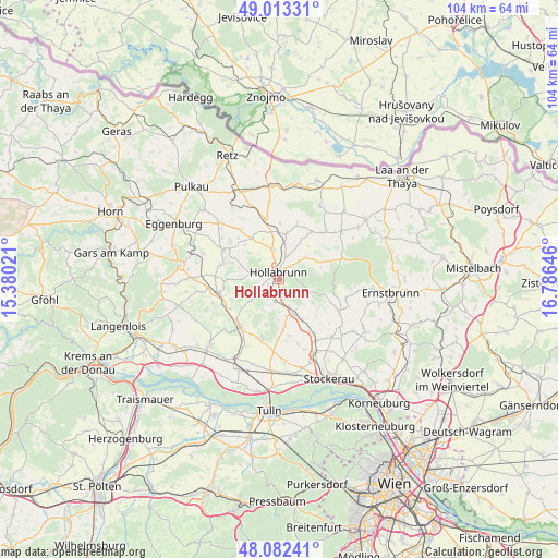
Hollabrunn GPS coordinates[2]
48° 33' 0" North, 16° 4' 59.988" East
| Map corner | latitude | longitude |
|---|---|---|
| Upper-left | 49.01331°, | 15.38021° |
| Center: | 48.55°, | 16.08333° |
| Lower-right: | 48.08241°, | 16.78646° |
| Map W x H: | 103.5×103.5 km | = 64.3×64.3mi |
| max Lat: | 48.98333° ⇑4.5% North |
| Hollabrunn: | 48.55° |
| min Lat: | ⇓95.5% South 46.48841° |
| min Long | Hollabrunn | max Long |
| 9.57802° | 16.08333° | 17.1° |
| W 82.4%⇐ | ⇒17.6% E |
Elevation
Elevation of Hollabrunn is 257 m = 843 ft, and this is 248.5 m = 815 ft below average elevation for this country.
| Max E: |
2140 m = 7021 ft | 83.2% |
| Avg. | 505.5 m = 1658 ft | |
| Hollabrunn | 257 m = 843 ft | |
Min E: |
118 m = 387 ft | 16.8% |
See also: Austria elevation on elevation.city.
Geographical zone
Hollabrunn is located in North temperate zone (between Tropic of Cancer and the Arctic Circle). Distance of this North polar circle is 2002.9 km =1244.5 mi to North.| Distance of | km | miles | from Hollabrunn |
|---|---|---|---|
| North Pole | 4608.8 | 2863.8 | to North |
| Arctic Circle | 2002.9 | 1244.5 | to North |
| Tropic Cancer | 2792.3 | 1735.1 | to South |
| Equator | 5398.3 | 3354.3 | to South |


Nearby cities:
15 places around Hollabrunn: (largest is in red/bold)
• Alberndorf
16.7 km =10.4 mi,  4°
4°
• Breitenwaida
5.7 km =3.5 mi,  192°
192°
• Großmugl
12.2 km =7.6 mi,  117°
117°
• Großweikersdorf
11.5 km =7.1 mi,  220°
220°
• Guntersdorf
11.4 km =7.1 mi,  347°
347°
• Göllersdorf
6.8 km =4.2 mi,  157°
157°
• Mailberg
15.5 km =9.6 mi,  27°
27°
• Niederrußbach
11.7 km =7.3 mi,  198°
198°
• Schöngrabern
6.1 km =3.8 mi,  336°
336°
• Sierndorf
14.7 km =9.1 mi, 155°
• Sitzendorf an der Schmida
11.7 km =7.3 mi,  297°
297°
• Sonnberg
3.1 km =1.9 mi,  232°
232°
• Stetteldorf am Wagram
16.5 km =10.3 mi, 196°
• Wullersdorf
8.8 km =5.5 mi,  8°
8°
• Ziersdorf
11.7 km =7.3 mi,  259°
259°
Sources, notices
• [Note1] Compared only with cities in Austria existing in our database
• [Src1] Map data: © OpenStreetMap contributors (CC-BY-SA)
• [Src2] Other city data from geonames.org with taken over terms of usage.
• [Src3] Geographical zone / Annual Mean Temperature by Robert A. Rohde @ Wikipedia
