Mailberg geodata
Mailberg (Lower Austria) is a seat of a third-order administrative division; located in Austria in Europe/Vienna (GMT+2) time zone. With population of 558 people, there are 2283 cities with bigger population in this country. Compared to other cities in Austria, 97.8% of cities are located further ↓South; 85.6% of cities are located further ←West and 90.7% of cities have higher elevation than Mailberg. Note1
Administrative division(s):
- Level 1: Lower Austria
- Level 2: Politischer Bezirk Hollabrunn
- Level 3: Mailberg


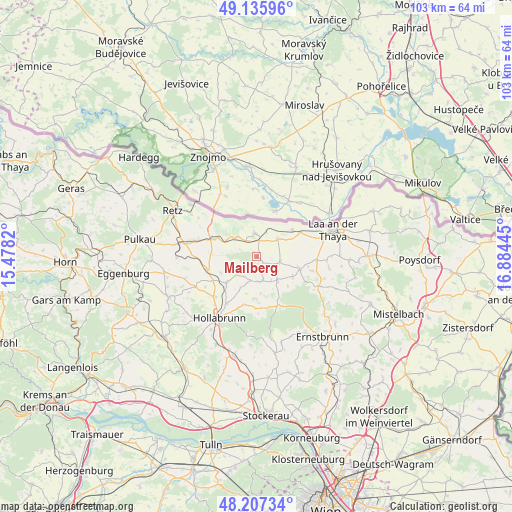
Mailberg GPS coordinates[2]
48° 40' 25.644" North, 16° 10' 52.752" East
| Map corner | latitude | longitude |
|---|---|---|
| Upper-left | 49.13596°, | 15.4782° |
| Center: | 48.67379°, | 16.18132° |
| Lower-right: | 48.20734°, | 16.88445° |
| Map W x H: | 103.3×103.3 km | = 64.2×64.2mi |
| max Lat: | 48.98333° ⇑2.2% North |
| Mailberg: | 48.67379° |
| min Lat: | ⇓97.8% South 46.48841° |
| min Long | Mailberg | max Long |
| 9.57802° | 16.18132° | 17.1° |
| W 85.6%⇐ | ⇒14.4% E |
Elevation
Elevation of Mailberg is 209 m = 686 ft, and this is 296.5 m = 973 ft below average elevation for this country.
| Max E: |
2140 m = 7021 ft | 90.7% |
| Avg. | 505.5 m = 1658 ft | |
| Mailberg | 209 m = 686 ft | |
Min E: |
118 m = 387 ft | 9.3% |
See also: Austria elevation on elevation.city.
Geographical zone
Mailberg is located in North temperate zone (between Tropic of Cancer and the Arctic Circle). Distance of this North polar circle is 1989.2 km =1236 mi to North.| Distance of | km | miles | from Mailberg |
|---|---|---|---|
| North Pole | 4595 | 2855.2 | to North |
| Arctic Circle | 1989.2 | 1236 | to North |
| Tropic Cancer | 2806.1 | 1743.6 | to South |
| Equator | 5412 | 3362.9 | to South |


Nearby cities:
15 places around Mailberg: (largest is in red/bold)
• Alberndorf
6.6 km =4.1 mi,  296°
296°
• Gaubitsch
15.1 km =9.4 mi,  100°
100°
• Großharras
4.8 km =3 mi, 103°
• Großkadolz
4.3 km =2.7 mi,  4°
4°
• Guntersdorf
10 km =6.2 mi,  254°
254°
• Hadres
5.5 km =3.4 mi,  316°
316°
• Hanfthal
13.9 km =8.6 mi,  77°
77°
• Haugsdorf
8.6 km =5.3 mi, 296°
• Obritz
3.7 km =2.3 mi, 321°
• Pernersdorf
12.4 km =7.7 mi,  283°
283°
• Schöngrabern
12.7 km =7.9 mi,  229°
229°
• Stronsdorf
9 km =5.6 mi,  105°
105°
• Unterstinkenbrunn
12.1 km =7.5 mi,  93°
93°
• Wullersdorf
7.8 km =4.8 mi, 229°
• Wulzeshofen
9.9 km =6.2 mi,  61°
61°
Sources, notices
• [Note1] Compared only with cities in Austria existing in our database
• [Src1] Map data: © OpenStreetMap contributors (CC-BY-SA)
• [Src2] Other city data from geonames.org with taken over terms of usage.
• [Src3] Geographical zone / Annual Mean Temperature by Robert A. Rohde @ Wikipedia
