Muhr geodata
Muhr (Salzburg) is a seat of a third-order administrative division; located in Austria in Europe/Vienna (GMT+2) time zone. In our database, there are 2958 cities with bigger population. Compared to other cities in Austria, 79.3% of cities are located further ↑North; 74.9% of cities are located further →East and 96.7% of cities have lower elevation than Muhr. Note1


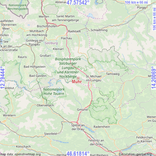
Muhr GPS coordinates[2]
47° 5' 56.148" North, 13° 29' 51.216" East
| Map corner | latitude | longitude |
|---|---|---|
| Upper-left | 47.57542°, | 12.79444° |
| Center: | 47.09893°, | 13.49756° |
| Lower-right: | 46.61814°, | 14.20069° |
| Map W x H: | 106.4×106.4 km | = 66.1×66.1mi |
| max Lat: | 48.98333° ⇑79.3% North |
| Muhr: | 47.09893° |
| min Lat: | ⇓20.7% South 46.48841° |
| min Long | Muhr | max Long |
| 9.57802° | 13.49756° | 17.1° |
| W 25.1%⇐ | ⇒74.9% E |
Elevation
Elevation of Muhr is 1113 m = 3652 ft, and this is 607.5 m = 1993 ft above average elevation for this country.
| Max E: |
2140 m = 7021 ft | 3.3% |
| Muhr | 1113 m 3652 ft | |
| Avg. | 505.5 m = 1658 ft | |
Min E: |
118 m = 387 ft | 96.7% |
See also: Austria elevation on elevation.city.
Geographical zone
Muhr is located in North temperate zone (between Tropic of Cancer and the Arctic Circle). Distance of this North polar circle is 2164.3 km =1344.8 mi to North.| Distance of | km | miles | from Muhr |
|---|---|---|---|
| North Pole | 4770.2 | 2964.1 | to North |
| Arctic Circle | 2164.3 | 1344.8 | to North |
| Tropic Cancer | 2631 | 1634.8 | to South |
| Equator | 5236.9 | 3254.1 | to South |


Nearby cities:
15 places around Muhr: (largest is in red/bold)
• Gmünd
21.5 km =13.4 mi,  173°
173°
• Hüttschlag
21.8 km =13.5 mi,  293°
293°
• Malta
16.1 km =10 mi,  177°
177°
• Mariapfarr
19.9 km =12.4 mi,  73°
73°
• Mauterndorf
14.3 km =8.9 mi, 73°
• Mörtelsdorf
22.3 km =13.9 mi,  81°
81°
• Rennweg am Katschberg
12.8 km =8 mi,  135°
135°
• Sankt Margarethen im Lungau
15.2 km =9.4 mi,  98°
98°
• Sankt Martin
11.5 km =7.1 mi,  89°
89°
• Sankt Michael im Lungau
10.3 km =6.4 mi, 89°
• Thomatal
19.4 km =12.1 mi, 100°
• Tweng
12.2 km =7.6 mi,  39°
39°
• Unternberg
18.6 km =11.6 mi, 85°
• Untertauern
22.4 km =13.9 mi,  0°
0°
• Zederhaus
6.3 km =3.9 mi,  5°
5°
Sources, notices
• [Note1] Compared only with cities in Austria existing in our database
• [Src1] Map data: © OpenStreetMap contributors (CC-BY-SA)
• [Src2] Other city data from geonames.org with taken over terms of usage.
• [Src3] Geographical zone / Annual Mean Temperature by Robert A. Rohde @ Wikipedia
