Sankt Lorenz geodata
Sankt Lorenz (Upper Austria) is a seat of a third-order administrative division; located in Austria in Europe/Vienna (GMT+2) time zone. With population of 1,554 people, there are 804 cities with bigger population in this country. Compared to other cities in Austria, 58.1% of cities are located further ↓South; 77.2% of cities are located further →East and 55.7% of cities have lower elevation than Sankt Lorenz. Note1
Administrative division(s):
- Level 1: Upper Austria
- Level 2: Politischer Bezirk Vöcklabruck
- Level 3: Sankt Lorenz


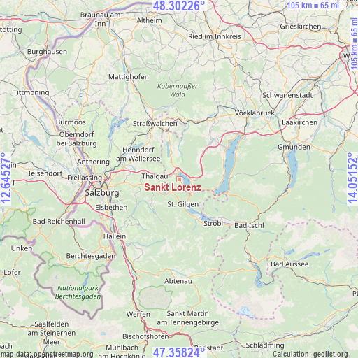
Sankt Lorenz GPS coordinates[2]
47° 49' 56.64" North, 13° 20' 54.204" East
| Map corner | latitude | longitude |
|---|---|---|
| Upper-left | 48.30226°, | 12.64527° |
| Center: | 47.8324°, | 13.34839° |
| Lower-right: | 47.35824°, | 14.05152° |
| Map W x H: | 105×105 km | = 65.2×65.2mi |
| max Lat: | 48.98333° ⇑41.9% North |
| Sankt Lorenz: | 47.8324° |
| min Lat: | ⇓58.1% South 46.48841° |
| min Long | Sankt Lorenz | max Long |
| 9.57802° | 13.34839° | 17.1° |
| W 22.8%⇐ | ⇒77.2% E |
Elevation
Elevation of Sankt Lorenz is 490 m = 1608 ft, and this is 15.5 m = 51 ft below average elevation for this country.
| Max E: |
2140 m = 7021 ft | 44.3% |
| Avg. | 505.5 m = 1658 ft | |
| Sankt Lorenz | 490 m = 1608 ft | |
Min E: |
118 m = 387 ft | 55.7% |
See also: Austria elevation on elevation.city.
Geographical zone
Sankt Lorenz is located in North temperate zone (between Tropic of Cancer and the Arctic Circle). Distance of this North polar circle is 2082.7 km =1294.1 mi to North.| Distance of | km | miles | from Sankt Lorenz |
|---|---|---|---|
| North Pole | 4688.6 | 2913.4 | to North |
| Arctic Circle | 2082.7 | 1294.1 | to North |
| Tropic Cancer | 2712.5 | 1685.5 | to South |
| Equator | 5318.5 | 3304.8 | to South |


Nearby cities:
15 places around Sankt Lorenz: (largest is in red/bold)
• Fuschl am See
5.1 km =3.2 mi,  225°
225°
• Gaisberg
2.3 km =1.4 mi,  338°
338°
• Guggenberg
5.8 km =3.6 mi,  348°
348°
• Hof
4.5 km =2.8 mi,  328°
328°
• Innerschwand
3.9 km =2.4 mi,  88°
88°
• Keuschen
3.6 km =2.2 mi,  271°
271°
• Mondsee
2.7 km =1.7 mi,  1°
1°
• Oberwang
7.4 km =4.6 mi,  58°
58°
• Pöllach
5.5 km =3.4 mi,  178°
178°
• Sankt Gilgen
7.4 km =4.6 mi,  169°
169°
• Thalgau
7.2 km =4.5 mi,  278°
278°
• Thalgauberg
7.1 km =4.4 mi,  293°
293°
• Tiefgraben
5.6 km =3.5 mi, 325°
• Unterdorf
9.1 km =5.7 mi, 278°
• Zell am Moos
7.9 km =4.9 mi, 342°
Sources, notices
• [Note1] Compared only with cities in Austria existing in our database
• [Src1] Map data: © OpenStreetMap contributors (CC-BY-SA)
• [Src2] Other city data from geonames.org with taken over terms of usage.
• [Src3] Geographical zone / Annual Mean Temperature by Robert A. Rohde @ Wikipedia
