Thalgauberg geodata
Thalgauberg (Salzburg) is a populated locality; located in Austria in Europe/Vienna (GMT+2) time zone. With population of 501 people, there are 2505 cities with bigger population in this country. Compared to other cities in Austria, 59.3% of cities are located further ↓South; 78.1% of cities are located further →East and 80.9% of cities have lower elevation than Thalgauberg. Note1
Administrative division(s):
- Level 1: Salzburg
- Level 2: Politischer Bezirk Salzburg-Umgebung
- Level 3: Thalgau


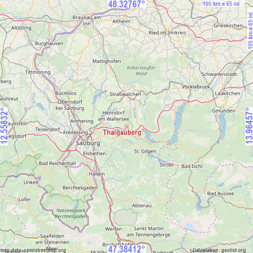
Thalgauberg GPS coordinates[2]
47° 51' 28.944" North, 13° 15' 41.184" East
| Map corner | latitude | longitude |
|---|---|---|
| Upper-left | 48.32767°, | 12.55832° |
| Center: | 47.85804°, | 13.26144° |
| Lower-right: | 47.38412°, | 13.96457° |
| Map W x H: | 104.9×104.9 km | = 65.2×65.2mi |
| max Lat: | 48.98333° ⇑40.7% North |
| Thalgauberg: | 47.85804° |
| min Lat: | ⇓59.3% South 46.48841° |
| min Long | Thalgauberg | max Long |
| 9.57802° | 13.26144° | 17.1° |
| W 21.9%⇐ | ⇒78.1% E |
Elevation
Elevation of Thalgauberg is 733 m = 2405 ft, and this is 227.5 m = 746 ft above average elevation for this country.
| Max E: |
2140 m = 7021 ft | 19.1% |
| Thalgauberg | 733 m 2405 ft | |
| Avg. | 505.5 m = 1658 ft | |
Min E: |
118 m = 387 ft | 80.9% |
See also: Austria elevation on elevation.city.
Geographical zone
Thalgauberg is located in North temperate zone (between Tropic of Cancer and the Arctic Circle). Distance of this North polar circle is 2079.9 km =1292.4 mi to North.| Distance of | km | miles | from Thalgauberg |
|---|---|---|---|
| North Pole | 4685.7 | 2911.6 | to North |
| Arctic Circle | 2079.9 | 1292.4 | to North |
| Tropic Cancer | 2715.4 | 1687.3 | to South |
| Equator | 5321.3 | 3306.5 | to South |


Nearby cities:
15 places around Thalgauberg: (largest is in red/bold)
• Enzersberg
4.7 km =2.9 mi,  258°
258°
• Fuschl am See
7.1 km =4.4 mi,  155°
155°
• Gaisberg
5.7 km =3.5 mi,  97°
97°
• Guggenberg
6.1 km =3.8 mi,  62°
62°
• Henndorf am Wallersee
7.5 km =4.7 mi,  308°
308°
• Hof
4.2 km =2.6 mi,  76°
76°
• Hof bei Salzburg
5.5 km =3.4 mi,  218°
218°
• Keuschen
4 km =2.5 mi,  133°
133°
• Mondsee
6.5 km =4 mi,  91°
91°
• Plainfeld
6.4 km =4 mi,  244°
244°
• Sankt Lorenz
7.1 km =4.4 mi,  113°
113°
• Thalgau
1.9 km =1.2 mi,  198°
198°
• Tiefgraben
3.8 km =2.4 mi, 62°
• Unterdorf
2.9 km =1.8 mi, 239°
• Zell am Moos
6.2 km =3.9 mi,  41°
41°
Sources, notices
• [Note1] Compared only with cities in Austria existing in our database
• [Src1] Map data: © OpenStreetMap contributors (CC-BY-SA)
• [Src2] Other city data from geonames.org with taken over terms of usage.
• [Src3] Geographical zone / Annual Mean Temperature by Robert A. Rohde @ Wikipedia
