Keuschen geodata
Keuschen (Upper Austria) is a populated place; located in Austria in Europe/Vienna (GMT+2) time zone. With population of 883 people, there are 1461 cities with bigger population in this country. Compared to other cities in Austria, 58.1% of cities are located further ↓South; 77.9% of cities are located further →East and 61.3% of cities have lower elevation than Keuschen. Note1
Administrative division(s):
- Level 1: Upper Austria
- Level 2: Politischer Bezirk Vöcklabruck
- Level 3: Sankt Lorenz


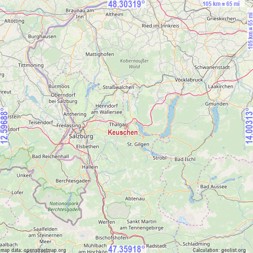
Keuschen GPS coordinates[2]
47° 49' 59.988" North, 13° 18' 0" East
| Map corner | latitude | longitude |
|---|---|---|
| Upper-left | 48.30319°, | 12.59688° |
| Center: | 47.83333°, | 13.3° |
| Lower-right: | 47.35918°, | 14.00313° |
| Map W x H: | 105×105 km | = 65.2×65.2mi |
| max Lat: | 48.98333° ⇑41.9% North |
| Keuschen: | 47.83333° |
| min Lat: | ⇓58.1% South 46.48841° |
| min Long | Keuschen | max Long |
| 9.57802° | 13.3° | 17.1° |
| W 22.1%⇐ | ⇒77.9% E |
Elevation
Elevation of Keuschen is 526 m = 1726 ft, and this is 20.5 m = 67 ft above average elevation for this country.
| Max E: |
2140 m = 7021 ft | 38.7% |
| Keuschen | 526 m 1726 ft | |
| Avg. | 505.5 m = 1658 ft | |
Min E: |
118 m = 387 ft | 61.3% |
See also: Austria elevation on elevation.city.
Geographical zone
Keuschen is located in North temperate zone (between Tropic of Cancer and the Arctic Circle). Distance of this North polar circle is 2082.6 km =1294.1 mi to North.| Distance of | km | miles | from Keuschen |
|---|---|---|---|
| North Pole | 4688.5 | 2913.3 | to North |
| Arctic Circle | 2082.6 | 1294.1 | to North |
| Tropic Cancer | 2712.6 | 1685.5 | to South |
| Equator | 5318.6 | 3304.8 | to South |


Nearby cities:
15 places around Keuschen: (largest is in red/bold)
• Enzersberg
7.7 km =4.8 mi,  283°
283°
• Fuschl am See
3.7 km =2.3 mi,  180°
180°
• Gaisberg
3.4 km =2.1 mi,  54°
54°
• Guggenberg
6.1 km =3.8 mi,  24°
24°
• Hof
3.9 km =2.4 mi, 18°
• Hof bei Salzburg
6.5 km =4 mi,  256°
256°
• Innerschwand
7.5 km =4.7 mi,  90°
90°
• Mondsee
4.5 km =2.8 mi, 54°
• Pöllach
6.7 km =4.2 mi,  146°
146°
• Sankt Lorenz
3.6 km =2.2 mi, 91°
• Thalgau
3.6 km =2.2 mi, 284°
• Thalgauberg
4 km =2.5 mi,  313°
313°
• Tiefgraben
4.5 km =2.8 mi,  5°
5°
• Unterdorf
5.5 km =3.4 mi, 283°
• Zell am Moos
7.5 km =4.7 mi, 9°
Sources, notices
• [Note1] Compared only with cities in Austria existing in our database
• [Src1] Map data: © OpenStreetMap contributors (CC-BY-SA)
• [Src2] Other city data from geonames.org with taken over terms of usage.
• [Src3] Geographical zone / Annual Mean Temperature by Robert A. Rohde @ Wikipedia
