Vorderbruck geodata
Vorderbruck (Lower Austria) is a populated place; located in Austria in Europe/Vienna (GMT+2) time zone. With population of 558 people, there are 2283 cities with bigger population in this country. Compared to other cities in Austria, 60% of cities are located further ↓South; 77.6% of cities are located further ←West and 52.6% of cities have lower elevation than Vorderbruck. Note1
Administrative division(s):
- Level 1: Lower Austria
- Level 2: Politischer Bezirk Wiener Neustadt
- Level 3: Gutenstein


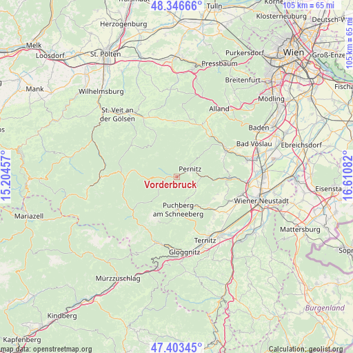
Vorderbruck GPS coordinates[2]
47° 52' 37.92" North, 15° 54' 27.684" East
| Map corner | latitude | longitude |
|---|---|---|
| Upper-left | 48.34666°, | 15.20457° |
| Center: | 47.8772°, | 15.90769° |
| Lower-right: | 47.40345°, | 16.61082° |
| Map W x H: | 104.9×104.9 km | = 65.2×65.2mi |
| max Lat: | 48.98333° ⇑40% North |
| Vorderbruck: | 47.8772° |
| min Lat: | ⇓60% South 46.48841° |
| min Long | Vorderbruck | max Long |
| 9.57802° | 15.90769° | 17.1° |
| W 77.6%⇐ | ⇒22.4% E |
Elevation
Elevation of Vorderbruck is 469 m = 1539 ft, and this is 36.5 m = 120 ft below average elevation for this country.
| Max E: |
2140 m = 7021 ft | 47.4% |
| Avg. | 505.5 m = 1658 ft | |
| Vorderbruck | 469 m = 1539 ft | |
Min E: |
118 m = 387 ft | 52.6% |
See also: Austria elevation on elevation.city.
Geographical zone
Vorderbruck is located in North temperate zone (between Tropic of Cancer and the Arctic Circle). Distance of this North polar circle is 2077.7 km =1291 mi to North.| Distance of | km | miles | from Vorderbruck |
|---|---|---|---|
| North Pole | 4683.6 | 2910.3 | to North |
| Arctic Circle | 2077.7 | 1291 | to North |
| Tropic Cancer | 2717.5 | 1688.6 | to South |
| Equator | 5323.4 | 3307.8 | to South |


Nearby cities:
15 places around Vorderbruck: (largest is in red/bold)
• Furth an der Triesting
11.7 km =7.3 mi,  24°
24°
• Grünbach am Schneeberg
10.7 km =6.6 mi,  145°
145°
• Gutenstein
1.4 km =0.9 mi,  264°
264°
• Maiersdorf
12.8 km =8 mi,  120°
120°
• Miesenbach
6.9 km =4.3 mi,  126°
126°
• Muggendorf
4.2 km =2.6 mi,  29°
29°
• Neusiedl
4.3 km =2.7 mi,  74°
74°
• Oberpiesting
14.3 km =8.9 mi,  90°
90°
• Pernitz
4.5 km =2.8 mi,  59°
59°
• Puchberg am Schneeberg
10 km =6.2 mi,  177°
177°
• Rohr im Gebirge
12.9 km =8 mi,  278°
278°
• Schrattenbach
12.5 km =7.8 mi, 150°
• Stollhof
13.2 km =8.2 mi,  113°
113°
• Waidmannsfeld
5.5 km =3.4 mi,  97°
97°
• Waldegg
10.8 km =6.7 mi, 95°
Sources, notices
• [Note1] Compared only with cities in Austria existing in our database
• [Src1] Map data: © OpenStreetMap contributors (CC-BY-SA)
• [Src2] Other city data from geonames.org with taken over terms of usage.
• [Src3] Geographical zone / Annual Mean Temperature by Robert A. Rohde @ Wikipedia
