Tschurndorf geodata
Tschurndorf (Burgenland) is a populated place; located in Austria in Europe/Vienna (GMT+2) time zone. With population of 501 people, there are 2505 cities with bigger population in this country. Compared to other cities in Austria, 50.8% of cities are located further ↓South; 91.4% of cities are located further ←West and 65.5% of cities have higher elevation than Tschurndorf. Note1
Administrative division(s):
- Level 1: Burgenland
- Level 2: Politischer Bezirk Oberpullendorf
- Level 3: Weppersdorf


Tschurndorf GPS coordinates[2]
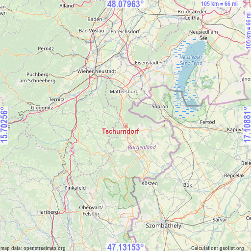
47° 36' 27.828" North, 16° 24' 20.448" East
| Map corner | latitude | longitude |
|---|---|---|
| Upper-left | 48.07963°, | 15.70256° |
| Center: | 47.60773°, | 16.40568° |
| Lower-right: | 47.13153°, | 17.10881° |
| Map W x H: | 105.4×105.4 km | = 65.5×65.5mi |
| max Lat: | 48.98333° ⇑49.2% North |
| Tschurndorf: | 47.60773° |
| min Lat: | ⇓50.8% South 46.48841° |
| min Long | Tschurndorf | max Long |
| 9.57802° | 16.40568° | 17.1° |
| W 91.4%⇐ | ⇒8.6% E |
Elevation
Elevation of Tschurndorf is 352 m = 1155 ft, and this is 153.5 m = 504 ft below average elevation for this country.
| Max E: |
2140 m = 7021 ft | 65.5% |
| Avg. | 505.5 m = 1658 ft | |
| Tschurndorf | 352 m = 1155 ft | |
Min E: |
118 m = 387 ft | 34.5% |
See also: Austria elevation on elevation.city.
Geographical zone
Tschurndorf is located in North temperate zone (between Tropic of Cancer and the Arctic Circle). Distance of this North polar circle is 2107.7 km =1309.7 mi to North.| Distance of | km | miles | from Tschurndorf |
|---|---|---|---|
| North Pole | 4713.6 | 2928.9 | to North |
| Arctic Circle | 2107.7 | 1309.7 | to North |
| Tropic Cancer | 2687.6 | 1670 | to South |
| Equator | 5293.5 | 3289.2 | to South |


Nearby cities:
15 places around Tschurndorf: (largest is in red/bold)
• Drassmarkt
10.1 km =6.3 mi,  182°
182°
• Kaisersdorf
7.9 km =4.9 mi,  187°
187°
• Kobersdorf
1.7 km =1.1 mi,  218°
218°
• Lackenbach
4.9 km =3 mi,  113°
113°
• Lackendorf
7.6 km =4.7 mi,  104°
104°
• Markt Sankt Martin
5.3 km =3.3 mi,  164°
164°
• Neutal
7.6 km =4.7 mi, 156°
• Oberpetersdorf
2.4 km =1.5 mi,  291°
291°
• Ritzing
6.8 km =4.2 mi,  84°
84°
• Schwarzenbach
5.1 km =3.2 mi,  307°
307°
• Sieggraben
5.2 km =3.2 mi,  338°
338°
• Stoob
10.3 km =6.4 mi,  148°
148°
• Unterfrauenhaid
8.1 km =5 mi,  120°
120°
• Weppersdorf
3.5 km =2.2 mi, 153°
• Wiesmath
9.2 km =5.7 mi,  276°
276°
Sources, notices
• [Note1] Compared only with cities in Austria existing in our database
• [Src1] Map data: © OpenStreetMap contributors (CC-BY-SA)
• [Src2] Other city data from geonames.org with taken over terms of usage.
• [Src3] Geographical zone / Annual Mean Temperature by Robert A. Rohde @ Wikipedia
