Oberpetersdorf geodata
Oberpetersdorf (Burgenland) is a populated place; located in Austria in Europe/Vienna (GMT+2) time zone. With population of 596 people, there are 2153 cities with bigger population in this country. Compared to other cities in Austria, 51% of cities are located further ↓South; 90.5% of cities are located further ←West and 65.2% of cities have higher elevation than Oberpetersdorf. Note1
Administrative division(s):
- Level 1: Burgenland
- Level 2: Politischer Bezirk Oberpullendorf
- Level 3: Kobersdorf


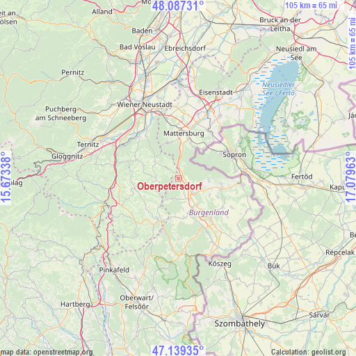
Oberpetersdorf GPS coordinates[2]
47° 36' 55.728" North, 16° 22' 35.4" East
| Map corner | latitude | longitude |
|---|---|---|
| Upper-left | 48.08731°, | 15.67338° |
| Center: | 47.61548°, | 16.3765° |
| Lower-right: | 47.13935°, | 17.07963° |
| Map W x H: | 105.4×105.4 km | = 65.5×65.5mi |
| max Lat: | 48.98333° ⇑49% North |
| Oberpetersdorf: | 47.61548° |
| min Lat: | ⇓51% South 46.48841° |
| min Long | Oberpetersdorf | max Long |
| 9.57802° | 16.3765° | 17.1° |
| W 90.5%⇐ | ⇒9.5% E |
Elevation
Elevation of Oberpetersdorf is 353 m = 1158 ft, and this is 152.5 m = 500 ft below average elevation for this country.
| Max E: |
2140 m = 7021 ft | 65.2% |
| Avg. | 505.5 m = 1658 ft | |
| Oberpetersdorf | 353 m = 1158 ft | |
Min E: |
118 m = 387 ft | 34.8% |
See also: Austria elevation on elevation.city.
Geographical zone
Oberpetersdorf is located in North temperate zone (between Tropic of Cancer and the Arctic Circle). Distance of this North polar circle is 2106.8 km =1309.1 mi to North.| Distance of | km | miles | from Oberpetersdorf |
|---|---|---|---|
| North Pole | 4712.7 | 2928.3 | to North |
| Arctic Circle | 2106.8 | 1309.1 | to North |
| Tropic Cancer | 2688.4 | 1670.5 | to South |
| Equator | 5294.3 | 3289.7 | to South |


Nearby cities:
15 places around Oberpetersdorf: (largest is in red/bold)
• Hochwolkersdorf
8.8 km =5.5 mi,  305°
305°
• Hollenthon
9.1 km =5.7 mi,  251°
251°
• Kaisersdorf
8.8 km =5.5 mi,  172°
172°
• Kobersdorf
2.5 km =1.6 mi,  152°
152°
• Lackenbach
7.2 km =4.5 mi,  112°
112°
• Lackendorf
10 km =6.2 mi, 106°
• Markt Sankt Martin
7 km =4.3 mi, 148°
• Neutal
9.4 km =5.8 mi, 146°
• Ritzing
8.9 km =5.5 mi,  91°
91°
• Schlatten
10.2 km =6.3 mi,  292°
292°
• Schwarzenbach
2.9 km =1.8 mi,  319°
319°
• Sieggraben
4 km =2.5 mi,  3°
3°
• Tschurndorf
2.4 km =1.5 mi, 111°
• Weppersdorf
5.5 km =3.4 mi,  136°
136°
• Wiesmath
7 km =4.3 mi,  271°
271°
Sources, notices
• [Note1] Compared only with cities in Austria existing in our database
• [Src1] Map data: © OpenStreetMap contributors (CC-BY-SA)
• [Src2] Other city data from geonames.org with taken over terms of usage.
• [Src3] Geographical zone / Annual Mean Temperature by Robert A. Rohde @ Wikipedia
