Obertraun geodata
Obertraun (Upper Austria) is a populated place; located in Austria in Europe/Vienna (GMT+2) time zone. With population of 613 people, there are 2090 cities with bigger population in this country. Compared to other cities in Austria, 51.2% of cities are located further ↑North; 71.6% of cities are located further →East and 59.3% of cities have lower elevation than Obertraun. Note1
Administrative division(s):
- Level 1: Upper Austria
- Level 2: Politischer Bezirk Gmunden
- Level 3: Obertraun


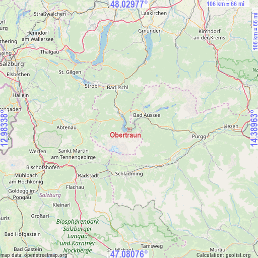
Obertraun GPS coordinates[2]
47° 33' 26.676" North, 13° 41' 11.4" East
| Map corner | latitude | longitude |
|---|---|---|
| Upper-left | 48.02977°, | 12.98338° |
| Center: | 47.55741°, | 13.6865° |
| Lower-right: | 47.08076°, | 14.38963° |
| Map W x H: | 105.5×105.5 km | = 65.6×65.6mi |
| max Lat: | 48.98333° ⇑51.2% North |
| Obertraun: | 47.55741° |
| min Lat: | ⇓48.8% South 46.48841° |
| min Long | Obertraun | max Long |
| 9.57802° | 13.6865° | 17.1° |
| W 28.4%⇐ | ⇒71.6% E |
Elevation
Elevation of Obertraun is 514 m = 1686 ft, and this is 8.5 m = 28 ft above average elevation for this country.
| Max E: |
2140 m = 7021 ft | 40.7% |
| Obertraun | 514 m 1686 ft | |
| Avg. | 505.5 m = 1658 ft | |
Min E: |
118 m = 387 ft | 59.3% |
See also: Austria elevation on elevation.city.
Geographical zone
Obertraun is located in North temperate zone (between Tropic of Cancer and the Arctic Circle). Distance of this North polar circle is 2113.3 km =1313.1 mi to North.| Distance of | km | miles | from Obertraun |
|---|---|---|---|
| North Pole | 4719.2 | 2932.4 | to North |
| Arctic Circle | 2113.3 | 1313.1 | to North |
| Tropic Cancer | 2682 | 1666.5 | to South |
| Equator | 5287.9 | 3285.7 | to South |


Nearby cities:
15 places around Obertraun: (largest is in red/bold)
• Altaussee
10.7 km =6.6 mi,  32°
32°
• Bad Aussee
9.3 km =5.8 mi,  50°
50°
• Bad Goisern
10.8 km =6.7 mi,  330°
330°
• Gosau
11.8 km =7.3 mi,  284°
284°
• Gschwandt
9.7 km =6 mi, 327°
• Haus
17.5 km =10.9 mi,  159°
159°
• Haus im Ennstal
17.4 km =10.8 mi, 159°
• Lerchenreith
8.2 km =5.1 mi, 47°
• Obertressen
9.8 km =6.1 mi, 47°
• Puchen
10.2 km =6.3 mi, 33°
• Ramsau am Dachstein
15.3 km =9.5 mi,  188°
188°
• Reiterndorf
16.8 km =10.4 mi,  345°
345°
• Sulzbach
16.2 km =10.1 mi,  341°
341°
• Untersee
7.1 km =4.4 mi, 337°
• Weißenbach
16.4 km =10.2 mi,  154°
154°
Sources, notices
• [Note1] Compared only with cities in Austria existing in our database
• [Src1] Map data: © OpenStreetMap contributors (CC-BY-SA)
• [Src2] Other city data from geonames.org with taken over terms of usage.
• [Src3] Geographical zone / Annual Mean Temperature by Robert A. Rohde @ Wikipedia
