Purkersdorf geodata
Purkersdorf (Lower Austria) is a seat of a third-order administrative division; located in Austria in Europe/Vienna (GMT+2) time zone. With population of 9,701 people, there are 80 cities with bigger population in this country. Compared to other cities in Austria, 79.8% of cities are located further ↓South; 85.4% of cities are located further ←West and 84.4% of cities have higher elevation than Purkersdorf. Note1
Administrative division(s):
- Level 1: Lower Austria
- Level 2: Politischer Bezirk Sankt Pölten
- Level 3: Purkersdorf


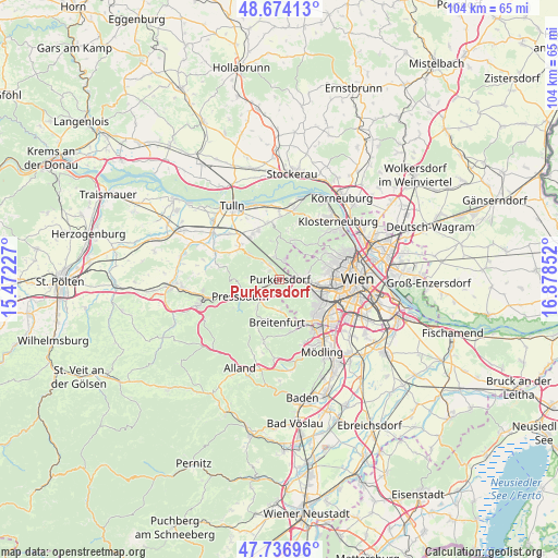
Purkersdorf GPS coordinates[2]
48° 12' 27.684" North, 16° 10' 31.404" East
| Map corner | latitude | longitude |
|---|---|---|
| Upper-left | 48.67413°, | 15.47227° |
| Center: | 48.20769°, | 16.17539° |
| Lower-right: | 47.73696°, | 16.87852° |
| Map W x H: | 104.2×104.2 km | = 64.7×64.7mi |
| max Lat: | 48.98333° ⇑20.2% North |
| Purkersdorf: | 48.20769° |
| min Lat: | ⇓79.8% South 46.48841° |
| min Long | Purkersdorf | max Long |
| 9.57802° | 16.17539° | 17.1° |
| W 85.4%⇐ | ⇒14.6% E |
Elevation
Elevation of Purkersdorf is 250 m = 820 ft, and this is 255.5 m = 838 ft below average elevation for this country.
| Max E: |
2140 m = 7021 ft | 84.4% |
| Avg. | 505.5 m = 1658 ft | |
| Purkersdorf | 250 m = 820 ft | |
Min E: |
118 m = 387 ft | 15.6% |
See also: Austria elevation on elevation.city.
Geographical zone
Purkersdorf is located in North temperate zone (between Tropic of Cancer and the Arctic Circle). Distance of this North polar circle is 2041 km =1268.2 mi to North.| Distance of | km | miles | from Purkersdorf |
|---|---|---|---|
| North Pole | 4646.9 | 2887.4 | to North |
| Arctic Circle | 2041 | 1268.2 | to North |
| Tropic Cancer | 2754.3 | 1711.4 | to South |
| Equator | 5360.2 | 3330.7 | to South |


Nearby cities:
15 places around Purkersdorf: (largest is in red/bold)
• Breitenfurt bei Wien
8.5 km =5.3 mi,  192°
192°
• Gablitz
2.8 km =1.7 mi,  326°
326°
• Hernals
7.3 km =4.5 mi,  67°
67°
• Hietzing
9.3 km =5.8 mi,  104°
104°
• Irenental
5.7 km =3.5 mi,  267°
267°
• Kirchbach
8.8 km =5.5 mi,  10°
10°
• Laab im Walde
5.9 km =3.7 mi,  181°
181°
• Mauerbach
4.2 km =2.6 mi,  352°
352°
• Ottakring
9.3 km =5.8 mi,  83°
83°
• Pressbaum
7.3 km =4.5 mi,  248°
248°
• Riederberg
7.4 km =4.6 mi,  309°
309°
• Tullnerbach-Lawies
6.6 km =4.1 mi, 251°
• Weidlingbach
8.6 km =5.3 mi,  40°
40°
• Wilfersdorf
9.6 km =6 mi, 325°
• Wolfsgraben
6.8 km =4.2 mi,  216°
216°
Sources, notices
• [Note1] Compared only with cities in Austria existing in our database
• [Src1] Map data: © OpenStreetMap contributors (CC-BY-SA)
• [Src2] Other city data from geonames.org with taken over terms of usage.
• [Src3] Geographical zone / Annual Mean Temperature by Robert A. Rohde @ Wikipedia
