Pressbaum geodata
Pressbaum (Lower Austria) is a seat of a third-order administrative division; located in Austria in Europe/Vienna (GMT+2) time zone. With population of 6,237 people, there are 157 cities with bigger population in this country. Compared to other cities in Austria, 77.8% of cities are located further ↓South; 82.4% of cities are located further ←West and 72.4% of cities have higher elevation than Pressbaum. Note1
Administrative division(s):
- Level 1: Lower Austria
- Level 2: Politischer Bezirk Sankt Pölten
- Level 3: Pressbaum


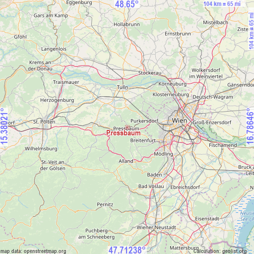
Pressbaum GPS coordinates[2]
48° 10' 59.988" North, 16° 4' 59.988" East
| Map corner | latitude | longitude |
|---|---|---|
| Upper-left | 48.65°, | 15.38021° |
| Center: | 48.18333°, | 16.08333° |
| Lower-right: | 47.71238°, | 16.78646° |
| Map W x H: | 104.3×104.3 km | = 64.8×64.8mi |
| max Lat: | 48.98333° ⇑22.2% North |
| Pressbaum: | 48.18333° |
| min Lat: | ⇓77.8% South 46.48841° |
| min Long | Pressbaum | max Long |
| 9.57802° | 16.08333° | 17.1° |
| W 82.4%⇐ | ⇒17.6% E |
Elevation
Elevation of Pressbaum is 317 m = 1040 ft, and this is 188.5 m = 618 ft below average elevation for this country.
| Max E: |
2140 m = 7021 ft | 72.4% |
| Avg. | 505.5 m = 1658 ft | |
| Pressbaum | 317 m = 1040 ft | |
Min E: |
118 m = 387 ft | 27.6% |
See also: Austria elevation on elevation.city.
Geographical zone
Pressbaum is located in North temperate zone (between Tropic of Cancer and the Arctic Circle). Distance of this North polar circle is 2043.7 km =1269.9 mi to North.| Distance of | km | miles | from Pressbaum |
|---|---|---|---|
| North Pole | 4649.6 | 2889.1 | to North |
| Arctic Circle | 2043.7 | 1269.9 | to North |
| Tropic Cancer | 2751.6 | 1709.8 | to South |
| Equator | 5357.5 | 3329 | to South |


Nearby cities:
15 places around Pressbaum: (largest is in red/bold)
• Breitenfurt bei Wien
7.4 km =4.6 mi,  138°
138°
• Eichgraben
7.5 km =4.7 mi,  260°
260°
• Elsbach
8 km =5 mi,  341°
341°
• Gablitz
7.3 km =4.5 mi,  46°
46°
• Hutten
7.3 km =4.5 mi,  265°
265°
• Irenental
2.7 km =1.7 mi,  24°
24°
• Laab im Walde
7.4 km =4.6 mi,  115°
115°
• Ottenheim
8 km =5 mi, 263°
• Pfalzau
3 km =1.9 mi,  211°
211°
• Purkersdorf
7.3 km =4.5 mi,  68°
68°
• Rekawinkel
4.4 km =2.7 mi, 264°
• Riederberg
7.5 km =4.7 mi,  8°
8°
• Stein
7.6 km =4.7 mi,  275°
275°
• Tullnerbach-Lawies
0.9 km =0.6 mi,  42°
42°
• Wolfsgraben
3.9 km =2.4 mi,  134°
134°
Sources, notices
• [Note1] Compared only with cities in Austria existing in our database
• [Src1] Map data: © OpenStreetMap contributors (CC-BY-SA)
• [Src2] Other city data from geonames.org with taken over terms of usage.
• [Src3] Geographical zone / Annual Mean Temperature by Robert A. Rohde @ Wikipedia
