Irenental geodata
Irenental (Lower Austria) is a populated place; located in Austria in Europe/Vienna (GMT+2) time zone. With population of 876 people, there are 1475 cities with bigger population in this country. Compared to other cities in Austria, 79.6% of cities are located further ↓South; 82.8% of cities are located further ←West and 72.6% of cities have higher elevation than Irenental. Note1
Administrative division(s):
- Level 1: Lower Austria
- Level 2: Politischer Bezirk Sankt Pölten
- Level 3: Tullnerbach


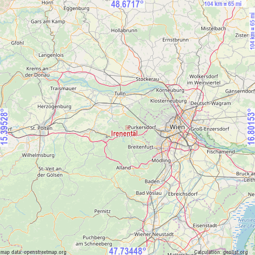
Irenental GPS coordinates[2]
48° 12' 18.828" North, 16° 5' 54.24" East
| Map corner | latitude | longitude |
|---|---|---|
| Upper-left | 48.6717°, | 15.39528° |
| Center: | 48.20523°, | 16.0984° |
| Lower-right: | 47.73448°, | 16.80153° |
| Map W x H: | 104.2×104.2 km | = 64.7×64.7mi |
| max Lat: | 48.98333° ⇑20.4% North |
| Irenental: | 48.20523° |
| min Lat: | ⇓79.6% South 46.48841° |
| min Long | Irenental | max Long |
| 9.57802° | 16.0984° | 17.1° |
| W 82.8%⇐ | ⇒17.2% E |
Elevation
Elevation of Irenental is 316 m = 1037 ft, and this is 189.5 m = 622 ft below average elevation for this country.
| Max E: |
2140 m = 7021 ft | 72.6% |
| Avg. | 505.5 m = 1658 ft | |
| Irenental | 316 m = 1037 ft | |
Min E: |
118 m = 387 ft | 27.4% |
See also: Austria elevation on elevation.city.
Geographical zone
Irenental is located in North temperate zone (between Tropic of Cancer and the Arctic Circle). Distance of this North polar circle is 2041.3 km =1268.4 mi to North.| Distance of | km | miles | from Irenental |
|---|---|---|---|
| North Pole | 4647.1 | 2887.6 | to North |
| Arctic Circle | 2041.3 | 1268.4 | to North |
| Tropic Cancer | 2754 | 1711.3 | to South |
| Equator | 5359.9 | 3330.5 | to South |


Nearby cities:
15 places around Irenental: (largest is in red/bold)
• Breitenfurt bei Wien
8.9 km =5.5 mi,  154°
154°
• Elsbach
6.3 km =3.9 mi,  325°
325°
• Gablitz
4.9 km =3 mi,  57°
57°
• Katzelsdorf
8.9 km =5.5 mi,  4°
4°
• Laab im Walde
7.9 km =4.9 mi,  135°
135°
• Mauerbach
6.8 km =4.2 mi,  49°
49°
• Pfalzau
5.6 km =3.5 mi,  208°
208°
• Pressbaum
2.7 km =1.7 mi,  204°
204°
• Purkersdorf
5.7 km =3.5 mi,  87°
87°
• Rekawinkel
6.2 km =3.9 mi,  242°
242°
• Riederberg
5 km =3.1 mi,  359°
359°
• Sieghartskirchen
8.5 km =5.3 mi,  311°
311°
• Tullnerbach-Lawies
1.9 km =1.2 mi, 196°
• Wilfersdorf
8.2 km =5.1 mi, 1°
• Wolfsgraben
5.4 km =3.4 mi,  162°
162°
Sources, notices
• [Note1] Compared only with cities in Austria existing in our database
• [Src1] Map data: © OpenStreetMap contributors (CC-BY-SA)
• [Src2] Other city data from geonames.org with taken over terms of usage.
• [Src3] Geographical zone / Annual Mean Temperature by Robert A. Rohde @ Wikipedia
