Osterwitz geodata
Osterwitz (Styria) is a seat of a third-order administrative division; located in Austria in Europe/Vienna (GMT+2) time zone. With population of 135 people, there are 2907 cities with bigger population in this country. Compared to other cities in Austria, 89.3% of cities are located further ↑North; 55.8% of cities are located further ←West and 97.3% of cities have lower elevation than Osterwitz. Note1
Administrative division(s):
- Level 1: Styria
- Level 2: Politischer Bezirk Deutschlandsberg
- Level 3: Deutschlandsberg


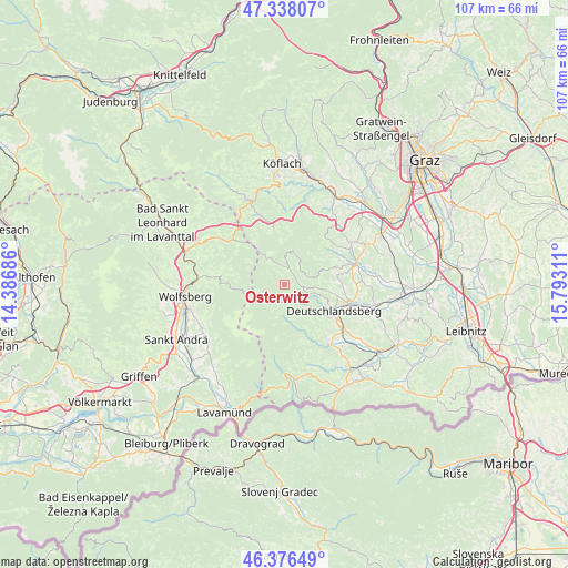
Osterwitz GPS coordinates[2]
46° 51' 33.948" North, 15° 5' 23.928" East
| Map corner | latitude | longitude |
|---|---|---|
| Upper-left | 47.33807°, | 14.38686° |
| Center: | 46.85943°, | 15.08998° |
| Lower-right: | 46.37649°, | 15.79311° |
| Map W x H: | 106.9×106.9 km | = 66.4×66.4mi |
| max Lat: | 48.98333° ⇑89.3% North |
| Osterwitz: | 46.85943° |
| min Lat: | ⇓10.7% South 46.48841° |
| min Long | Osterwitz | max Long |
| 9.57802° | 15.08998° | 17.1° |
| W 55.8%⇐ | ⇒44.2% E |
Elevation
Elevation of Osterwitz is 1146 m = 3760 ft, and this is 640.5 m = 2101 ft above average elevation for this country.
| Max E: |
2140 m = 7021 ft | 2.7% |
| Osterwitz | 1146 m 3760 ft | |
| Avg. | 505.5 m = 1658 ft | |
Min E: |
118 m = 387 ft | 97.3% |
See also: Austria elevation on elevation.city.
Geographical zone
Osterwitz is located in North temperate zone (between Tropic of Cancer and the Arctic Circle). Distance of this North polar circle is 2190.9 km =1361.4 mi to North.| Distance of | km | miles | from Osterwitz |
|---|---|---|---|
| North Pole | 4796.8 | 2980.6 | to North |
| Arctic Circle | 2190.9 | 1361.4 | to North |
| Tropic Cancer | 2604.4 | 1618.3 | to South |
| Equator | 5210.3 | 3237.5 | to South |


Nearby cities:
15 places around Osterwitz: (largest is in red/bold)
• Bad Gams
10.3 km =6.4 mi,  82°
82°
• Deutschlandsberg
11.2 km =7 mi,  116°
116°
• Freidorf an der Laßnitz
13.1 km =8.1 mi,  111°
111°
• Freiland bei Deutschlandsberg
4.4 km =2.7 mi,  131°
131°
• Garanas
10.5 km =6.5 mi,  168°
168°
• Greisdorf
12.3 km =7.6 mi,  52°
52°
• Gressenberg
6.9 km =4.3 mi,  162°
162°
• Hollenegg
12.1 km =7.5 mi, 128°
• Kloster
2.7 km =1.7 mi,  349°
349°
• Kothvogel
12.1 km =7.5 mi, 79°
• Lassnitz
13.1 km =8.1 mi, 111°
• Mainsdorf
11.9 km =7.4 mi,  150°
150°
• Modriach
10.5 km =6.5 mi,  343°
343°
• Rassach
13.7 km =8.5 mi,  89°
89°
• Trahütten
6.4 km =4 mi, 126°
Sources, notices
• [Note1] Compared only with cities in Austria existing in our database
• [Src1] Map data: © OpenStreetMap contributors (CC-BY-SA)
• [Src2] Other city data from geonames.org with taken over terms of usage.
• [Src3] Geographical zone / Annual Mean Temperature by Robert A. Rohde @ Wikipedia
