Freiland bei Deutschlandsberg geodata
Freiland bei Deutschlandsberg (Styria) is a seat of a third-order administrative division; located in Austria in Europe/Vienna (GMT+2) time zone. With population of 150 people, there are 2895 cities with bigger population in this country. Compared to other cities in Austria, 90.4% of cities are located further ↑North; 56.5% of cities are located further ←West and 87.9% of cities have lower elevation than Freiland bei Deutschlandsberg. Note1
Administrative division(s):
- Level 1: Styria
- Level 2: Politischer Bezirk Deutschlandsberg
- Level 3: Deutschlandsberg
Current local time in Freiland bei Deutschlandsberg:
01:16 AM, SaturdayDifference from your time zone: hours


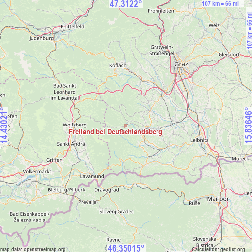
Freiland bei Deutschlandsberg GPS coordinates[2]
46° 49' 59.988" North, 15° 7' 59.988" East
| Map corner | latitude | longitude |
|---|---|---|
| Upper-left | 47.3122°, | 14.43021° |
| Center: | 46.83333°, | 15.13333° |
| Lower-right: | 46.35015°, | 15.83646° |
| Map W x H: | 107×107 km | = 66.5×66.5mi |
| max Lat: | 48.98333° ⇑90.4% North |
| Freiland bei Deutschlandsberg: | 46.83333° |
| min Lat: | ⇓9.6% South 46.48841° |
| min Long | Freiland bei De | max Long |
| 9.57802° | 15.13333° | 17.1° |
| W 56.5%⇐ | ⇒43.5% E |
Elevation
Elevation of Freiland bei Deutschlandsberg is 843 m = 2766 ft, and this is 337.5 m = 1107 ft above average elevation for this country.
| Max E: |
2140 m = 7021 ft | 12.1% |
| Freiland bei Deutschlandsberg | 843 m 2766 ft | |
| Avg. | 505.5 m = 1658 ft | |
Min E: |
118 m = 387 ft | 87.9% |
See also: Austria elevation on elevation.city.
Geographical zone
Freiland bei Deutschlandsberg is located in North temperate zone (between Tropic of Cancer and the Arctic Circle). Distance of this North polar circle is 2193.8 km =1363.2 mi to North.| Distance of | km | miles | from Freiland bei Deutschlandsberg |
|---|---|---|---|
| North Pole | 4799.7 | 2982.4 | to North |
| Arctic Circle | 2193.8 | 1363.2 | to North |
| Tropic Cancer | 2601.5 | 1616.5 | to South |
| Equator | 5207.4 | 3235.7 | to South |


Nearby cities:
15 places around Freiland bei Deutschlandsberg: (largest is in red/bold)
• Bad Gams
8.1 km =5 mi,  58°
58°
• Deutschlandsberg
7.1 km =4.4 mi,  106°
106°
• Freidorf an der Laßnitz
9.1 km =5.7 mi,  101°
101°
• Garanas
7.5 km =4.7 mi,  189°
189°
• Graschuh
12 km =7.5 mi, 63°
• Gressenberg
3.9 km =2.4 mi,  198°
198°
• Hollenegg
7.7 km =4.8 mi,  127°
127°
• Kloster
6.7 km =4.2 mi,  325°
325°
• Kothvogel
10 km =6.2 mi, 59°
• Lassnitz
9.1 km =5.7 mi, 101°
• Mainsdorf
7.8 km =4.8 mi,  161°
161°
• Osterwitz
4.4 km =2.7 mi,  311°
311°
• Rassach
10.8 km =6.7 mi,  73°
73°
• Schwanberg
10.1 km =6.3 mi,  145°
145°
• Trahütten
2 km =1.2 mi,  117°
117°
Sources, notices
• [Note1] Compared only with cities in Austria existing in our database
• [Src1] Map data: © OpenStreetMap contributors (CC-BY-SA)
• [Src2] Other city data from geonames.org with taken over terms of usage.
• [Src3] Geographical zone / Annual Mean Temperature by Robert A. Rohde @ Wikipedia
