Gressenberg geodata
Gressenberg (Styria) is a seat of a third-order administrative division; located in Austria in Europe/Vienna (GMT+2) time zone. With population of 286 people, there are 2767 cities with bigger population in this country. Compared to other cities in Austria, 92% of cities are located further ↑North; 56.1% of cities are located further ←West and 96.9% of cities have lower elevation than Gressenberg. Note1
Administrative division(s):
- Level 1: Styria
- Level 2: Politischer Bezirk Deutschlandsberg
- Level 3: Schwanberg


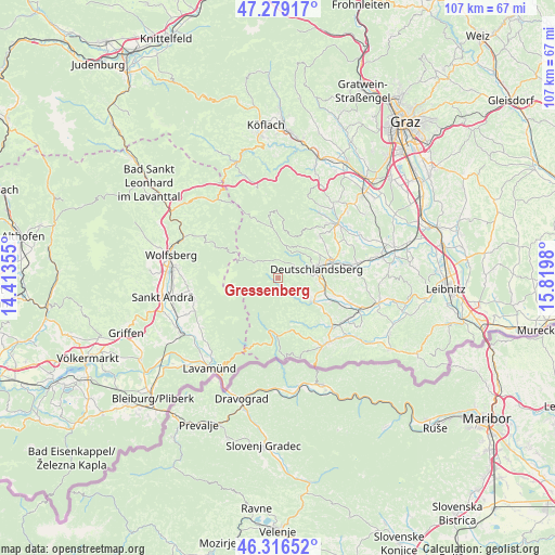
Gressenberg GPS coordinates[2]
46° 48' 0" North, 15° 7' 0.012" East
| Map corner | latitude | longitude |
|---|---|---|
| Upper-left | 47.27917°, | 14.41355° |
| Center: | 46.8°, | 15.11667° |
| Lower-right: | 46.31652°, | 15.8198° |
| Map W x H: | 107×107 km | = 66.5×66.5mi |
| max Lat: | 48.98333° ⇑92% North |
| Gressenberg: | 46.8° |
| min Lat: | ⇓8% South 46.48841° |
| min Long | Gressenberg | max Long |
| 9.57802° | 15.11667° | 17.1° |
| W 56.1%⇐ | ⇒43.9% E |
Elevation
Elevation of Gressenberg is 1122 m = 3681 ft, and this is 616.5 m = 2023 ft above average elevation for this country.
| Max E: |
2140 m = 7021 ft | 3.1% |
| Gressenberg | 1122 m 3681 ft | |
| Avg. | 505.5 m = 1658 ft | |
Min E: |
118 m = 387 ft | 96.9% |
See also: Austria elevation on elevation.city.
Geographical zone
Gressenberg is located in North temperate zone (between Tropic of Cancer and the Arctic Circle). Distance of this North polar circle is 2197.5 km =1365.5 mi to North.| Distance of | km | miles | from Gressenberg |
|---|---|---|---|
| North Pole | 4803.4 | 2984.7 | to North |
| Arctic Circle | 2197.5 | 1365.5 | to North |
| Tropic Cancer | 2597.8 | 1614.2 | to South |
| Equator | 5203.7 | 3233.4 | to South |


Nearby cities:
15 places around Gressenberg: (largest is in red/bold)
• Bad Gams
11.4 km =7.1 mi,  46°
46°
• Deutschlandsberg
8.2 km =5.1 mi,  78°
78°
• Freidorf an der Laßnitz
10.3 km =6.4 mi, 79°
• Freiland bei Deutschlandsberg
3.9 km =2.4 mi,  18°
18°
• Garanas
3.7 km =2.3 mi,  180°
180°
• Hollenegg
7.4 km =4.6 mi,  97°
97°
• Kloster
9.6 km =6 mi,  344°
344°
• Lassnitz
10.3 km =6.4 mi, 79°
• Mainsdorf
5.3 km =3.3 mi,  134°
134°
• Mitterlimberg
11.6 km =7.2 mi, 129°
• Osterwitz
6.9 km =4.3 mi, 342°
• Sankt Oswald ob Eibiswald
10.4 km =6.5 mi,  167°
167°
• Sankt Peter im Sulmtal
11.6 km =7.2 mi,  118°
118°
• Schwanberg
8.4 km =5.2 mi, 123°
• Trahütten
4.1 km =2.5 mi, 47°
Sources, notices
• [Note1] Compared only with cities in Austria existing in our database
• [Src1] Map data: © OpenStreetMap contributors (CC-BY-SA)
• [Src2] Other city data from geonames.org with taken over terms of usage.
• [Src3] Geographical zone / Annual Mean Temperature by Robert A. Rohde @ Wikipedia
