Marchegg geodata
Marchegg (Lower Austria) is a seat of a third-order administrative division; located in Austria in Europe/Vienna (GMT+2) time zone. With population of 2,199 people, there are 554 cities with bigger population in this country. Compared to other cities in Austria, 83.5% of cities are located further ↓South; 99.3% of cities are located further ←West and 99.1% of cities have higher elevation than Marchegg. Note1
Administrative division(s):
- Level 1: Lower Austria
- Level 2: Politischer Bezirk Gänserndorf
- Level 3: Marchegg


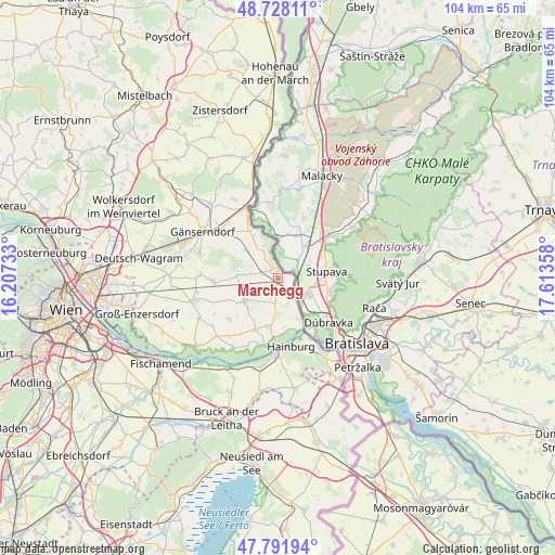
Marchegg GPS coordinates[2]
48° 15' 43.812" North, 16° 54' 37.62" East
| Map corner | latitude | longitude |
|---|---|---|
| Upper-left | 48.72811°, | 16.20733° |
| Center: | 48.26217°, | 16.91045° |
| Lower-right: | 47.79194°, | 17.61358° |
| Map W x H: | 104.1×104.1 km | = 64.7×64.7mi |
| max Lat: | 48.98333° ⇑16.5% North |
| Marchegg: | 48.26217° |
| min Lat: | ⇓83.5% South 46.48841° |
| min Long | Marchegg | max Long |
| 9.57802° | 16.91045° | 17.1° |
| W 99.3%⇐ | ⇒0.7% E |
Elevation
Elevation of Marchegg is 140 m = 459 ft, and this is 365.5 m = 1199 ft below average elevation for this country.
| Max E: |
2140 m = 7021 ft | 99.1% |
| Avg. | 505.5 m = 1658 ft | |
| Marchegg | 140 m = 459 ft | |
Min E: |
118 m = 387 ft | 0.9% |
See also: Austria elevation on elevation.city.
Geographical zone
Marchegg is located in North temperate zone (between Tropic of Cancer and the Arctic Circle). Distance of this North polar circle is 2034.9 km =1264.4 mi to North.| Distance of | km | miles | from Marchegg |
|---|---|---|---|
| North Pole | 4640.8 | 2883.7 | to North |
| Arctic Circle | 2034.9 | 1264.4 | to North |
| Tropic Cancer | 2760.3 | 1715.2 | to South |
| Equator | 5366.3 | 3334.5 | to South |


Nearby cities:
15 places around Marchegg: (largest is in red/bold)
• Angern an der March
14.2 km =8.8 mi,  334°
334°
• Bad Deutsch-Altenburg
14.2 km =8.8 mi,  181°
181°
• Breitensee
3.1 km =1.9 mi,  229°
229°
• Eckartsau
15.5 km =9.6 mi,  212°
212°
• Engelhartstetten
9.2 km =5.7 mi,  192°
192°
• Gänserndorf
16.5 km =10.3 mi,  301°
301°
• Hainburg an der Donau
13.1 km =8.1 mi,  168°
168°
• Haringsee
11.9 km =7.4 mi, 229°
• Hundsheim
16.2 km =10.1 mi, 173°
• Lassee
7.7 km =4.8 mi,  237°
237°
• Obersiebenbrunn
14.8 km =9.2 mi,  271°
271°
• Petronell-Carnuntum
16.9 km =10.5 mi, 191°
• Untersiebenbrunn
13.2 km =8.2 mi,  264°
264°
• Weikendorf
14 km =8.7 mi,  310°
310°
• Wolfsthal
15.8 km =9.8 mi,  155°
155°
Sources, notices
• [Note1] Compared only with cities in Austria existing in our database
• [Src1] Map data: © OpenStreetMap contributors (CC-BY-SA)
• [Src2] Other city data from geonames.org with taken over terms of usage.
• [Src3] Geographical zone / Annual Mean Temperature by Robert A. Rohde @ Wikipedia
