Gars am Kamp geodata
Gars am Kamp (Lower Austria) is a seat of a third-order administrative division; located in Austria in Europe/Vienna (GMT+2) time zone. With population of 1,907 people, there are 649 cities with bigger population in this country. Compared to other cities in Austria, 96.5% of cities are located further ↓South; 70.6% of cities are located further ←West and 85.1% of cities have higher elevation than Gars am Kamp. Note1
Administrative division(s):
- Level 1: Lower Austria
- Level 2: Politischer Bezirk Horn
- Level 3: Gars am Kamp


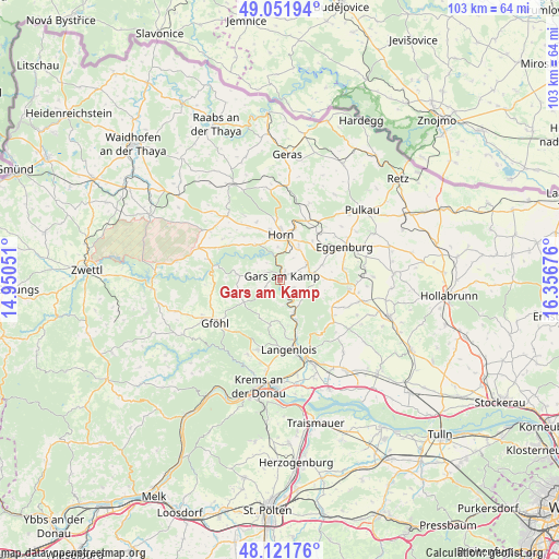
Gars am Kamp GPS coordinates[2]
48° 35' 20.364" North, 15° 39' 13.068" East
| Map corner | latitude | longitude |
|---|---|---|
| Upper-left | 49.05194°, | 14.95051° |
| Center: | 48.58899°, | 15.65363° |
| Lower-right: | 48.12176°, | 16.35676° |
| Map W x H: | 103.4×103.4 km | = 64.2×64.2mi |
| max Lat: | 48.98333° ⇑3.5% North |
| Gars am Kamp: | 48.58899° |
| min Lat: | ⇓96.5% South 46.48841° |
| min Long | Gars am Kamp | max Long |
| 9.57802° | 15.65363° | 17.1° |
| W 70.6%⇐ | ⇒29.4% E |
Elevation
Elevation of Gars am Kamp is 246 m = 807 ft, and this is 259.5 m = 851 ft below average elevation for this country.
| Max E: |
2140 m = 7021 ft | 85.1% |
| Avg. | 505.5 m = 1658 ft | |
| Gars am Kamp | 246 m = 807 ft | |
Min E: |
118 m = 387 ft | 14.9% |
See also: Austria elevation on elevation.city.
Geographical zone
Gars am Kamp is located in North temperate zone (between Tropic of Cancer and the Arctic Circle). Distance of this North polar circle is 1998.6 km =1241.9 mi to North.| Distance of | km | miles | from Gars am Kamp |
|---|---|---|---|
| North Pole | 4604.5 | 2861.1 | to North |
| Arctic Circle | 1998.6 | 1241.9 | to North |
| Tropic Cancer | 2796.7 | 1737.8 | to South |
| Equator | 5402.6 | 3357 | to South |


Nearby cities:
15 places around Gars am Kamp: (largest is in red/bold)
• Altenburg
7.9 km =4.9 mi,  325°
325°
• Eggenburg
13.4 km =8.3 mi,  65°
65°
• Frauenhofen
9.5 km =5.9 mi,  348°
348°
• Horn
8.2 km =5.1 mi,  1°
1°
• Langenlois
13.6 km =8.5 mi,  175°
175°
• Lengenfeld
13.6 km =8.5 mi,  197°
197°
• Maissau
13.1 km =8.1 mi,  97°
97°
• Röhrenbach
13.2 km =8.2 mi,  300°
300°
• Röschitz
13.5 km =8.4 mi,  63°
63°
• Sankt Leonhard am Hornerwald
8.9 km =5.5 mi,  277°
277°
• Schiltern
8.5 km =5.3 mi, 198°
• Schönberg
8.7 km =5.4 mi,  157°
157°
• Sigmundsherberg
12.7 km =7.9 mi,  34°
34°
• Wolfshoferamt
6.5 km =4 mi, 280°
• Zöbing
12 km =7.5 mi,  169°
169°
Sources, notices
• [Note1] Compared only with cities in Austria existing in our database
• [Src1] Map data: © OpenStreetMap contributors (CC-BY-SA)
• [Src2] Other city data from geonames.org with taken over terms of usage.
• [Src3] Geographical zone / Annual Mean Temperature by Robert A. Rohde @ Wikipedia
