Sigmundsherberg geodata
Sigmundsherberg (Lower Austria) is a seat of a third-order administrative division; located in Austria in Europe/Vienna (GMT+2) time zone. With population of 635 people, there are 2021 cities with bigger population in this country. Compared to other cities in Austria, 97.9% of cities are located further ↓South; 73.3% of cities are located further ←West and 53% of cities have higher elevation than Sigmundsherberg. Note1
Administrative division(s):
- Level 1: Lower Austria
- Level 2: Politischer Bezirk Horn
- Level 3: Sigmundsherberg


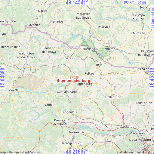
Sigmundsherberg GPS coordinates[2]
48° 40' 59.988" North, 15° 45' 0" East
| Map corner | latitude | longitude |
|---|---|---|
| Upper-left | 49.14541°, | 15.04688° |
| Center: | 48.68333°, | 15.75° |
| Lower-right: | 48.21697°, | 16.45313° |
| Map W x H: | 103.2×103.2 km | = 64.1×64.1mi |
| max Lat: | 48.98333° ⇑2.1% North |
| Sigmundsherberg: | 48.68333° |
| min Lat: | ⇓97.9% South 46.48841° |
| min Long | Sigmundsherberg | max Long |
| 9.57802° | 15.75° | 17.1° |
| W 73.3%⇐ | ⇒26.7% E |
Elevation
Elevation of Sigmundsherberg is 435 m = 1427 ft, and this is 70.5 m = 231 ft below average elevation for this country.
| Max E: |
2140 m = 7021 ft | 53% |
| Avg. | 505.5 m = 1658 ft | |
| Sigmundsherberg | 435 m = 1427 ft | |
Min E: |
118 m = 387 ft | 47% |
See also: Austria elevation on elevation.city.
Geographical zone
Sigmundsherberg is located in North temperate zone (between Tropic of Cancer and the Arctic Circle). Distance of this North polar circle is 1988.1 km =1235.3 mi to North.| Distance of | km | miles | from Sigmundsherberg |
|---|---|---|---|
| North Pole | 4594 | 2854.6 | to North |
| Arctic Circle | 1988.1 | 1235.3 | to North |
| Tropic Cancer | 2807.2 | 1744.3 | to South |
| Equator | 5413.1 | 3363.5 | to South |


Nearby cities:
15 places around Sigmundsherberg: (largest is in red/bold)
• Altenburg
12.2 km =7.6 mi,  251°
251°
• Eggenburg
7.1 km =4.4 mi,  134°
134°
• Frauenhofen
9 km =5.6 mi,  262°
262°
• Gars am Kamp
12.7 km =7.9 mi,  214°
214°
• Geras
13.9 km =8.6 mi,  335°
335°
• Horn
7.2 km =4.5 mi, 251°
• Maissau
13.6 km =8.5 mi,  154°
154°
• Pernegg
11.3 km =7 mi,  299°
299°
• Pulkau
8.4 km =5.2 mi,  73°
73°
• Röschitz
6.7 km =4.2 mi, 131°
• Schrattenthal
11.2 km =7 mi,  80°
80°
• Unternalb
16.5 km =10.3 mi, 67°
• Weitersfeld
11.8 km =7.3 mi,  23°
23°
• Wolfshoferamt
16.3 km =10.1 mi,  235°
235°
• Zellerndorf
15.4 km =9.6 mi, 84°
Sources, notices
• [Note1] Compared only with cities in Austria existing in our database
• [Src1] Map data: © OpenStreetMap contributors (CC-BY-SA)
• [Src2] Other city data from geonames.org with taken over terms of usage.
• [Src3] Geographical zone / Annual Mean Temperature by Robert A. Rohde @ Wikipedia
