Losenstein geodata
Losenstein (Upper Austria) is a seat of a third-order administrative division; located in Austria in Europe/Vienna (GMT+2) time zone. With population of 1,604 people, there are 780 cities with bigger population in this country. Compared to other cities in Austria, 62% of cities are located further ↓South; 54.7% of cities are located further →East and 57.9% of cities have higher elevation than Losenstein. Note1
Administrative division(s):
- Level 1: Upper Austria
- Level 2: Politischer Bezirk Steyr-Land
- Level 3: Losenstein


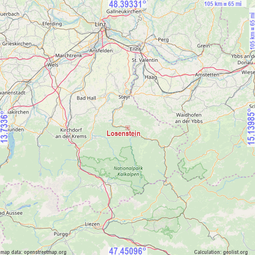
Losenstein GPS coordinates[2]
47° 55' 27.408" North, 14° 26' 12.192" East
| Map corner | latitude | longitude |
|---|---|---|
| Upper-left | 48.39331°, | 13.7336° |
| Center: | 47.92428°, | 14.43672° |
| Lower-right: | 47.45096°, | 15.13985° |
| Map W x H: | 104.8×104.8 km | = 65.1×65.1mi |
| max Lat: | 48.98333° ⇑38% North |
| Losenstein: | 47.92428° |
| min Lat: | ⇓62% South 46.48841° |
| min Long | Losenstein | max Long |
| 9.57802° | 14.43672° | 17.1° |
| W 45.3%⇐ | ⇒54.7% E |
Elevation
Elevation of Losenstein is 399 m = 1309 ft, and this is 106.5 m = 349 ft below average elevation for this country.
| Max E: |
2140 m = 7021 ft | 57.9% |
| Avg. | 505.5 m = 1658 ft | |
| Losenstein | 399 m = 1309 ft | |
Min E: |
118 m = 387 ft | 42.1% |
See also: Austria elevation on elevation.city.
Geographical zone
Losenstein is located in North temperate zone (between Tropic of Cancer and the Arctic Circle). Distance of this North polar circle is 2072.5 km =1287.8 mi to North.| Distance of | km | miles | from Losenstein |
|---|---|---|---|
| North Pole | 4678.4 | 2907 | to North |
| Arctic Circle | 2072.5 | 1287.8 | to North |
| Tropic Cancer | 2722.8 | 1691.9 | to South |
| Equator | 5328.7 | 3311.1 | to South |


Nearby cities:
15 places around Losenstein: (largest is in red/bold)
• Arzberg
4.8 km =3 mi,  133°
133°
• Aschach an der Steyr
12.4 km =7.7 mi,  322°
322°
• Behamberg
10.8 km =6.7 mi,  18°
18°
• Garsten
11.1 km =6.9 mi,  348°
348°
• Grossraming
9.6 km =6 mi,  118°
118°
• Kleinraming
9.1 km =5.7 mi, 22°
• Kürnberg
11.1 km =6.9 mi,  40°
40°
• Lahrndorf
8.9 km =5.5 mi,  331°
331°
• Laussa
3 km =1.9 mi, 19°
• Lumplgraben
9.6 km =6 mi, 131°
• Maria Neustift
12.2 km =7.6 mi,  85°
85°
• Reichraming
4.7 km =2.9 mi,  167°
167°
• Sankt Ulrich bei Steyr
10.8 km =6.7 mi,  0°
0°
• Ternberg
6.3 km =3.9 mi,  291°
291°
• Unterwald
10.5 km =6.5 mi,  12°
12°
Sources, notices
• [Note1] Compared only with cities in Austria existing in our database
• [Src1] Map data: © OpenStreetMap contributors (CC-BY-SA)
• [Src2] Other city data from geonames.org with taken over terms of usage.
• [Src3] Geographical zone / Annual Mean Temperature by Robert A. Rohde @ Wikipedia
