Unterbergla geodata
Unterbergla (Styria) is a seat of a third-order administrative division; located in Austria in Europe/Vienna (GMT+2) time zone. With population of 272 people, there are 2783 cities with bigger population in this country. Compared to other cities in Austria, 91.7% of cities are located further ↑North; 60.4% of cities are located further ←West and 66.4% of cities have higher elevation than Unterbergla. Note1
Administrative division(s):
- Level 1: Styria
- Level 2: Politischer Bezirk Deutschlandsberg
- Level 3: Groß Sankt Florian


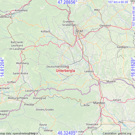
Unterbergla GPS coordinates[2]
46° 48' 26.856" North, 15° 18' 54.576" East
| Map corner | latitude | longitude |
|---|---|---|
| Upper-left | 47.28656°, | 14.61204° |
| Center: | 46.80746°, | 15.31516° |
| Lower-right: | 46.32405°, | 16.01829° |
| Map W x H: | 107×107 km | = 66.5×66.5mi |
| max Lat: | 48.98333° ⇑91.7% North |
| Unterbergla: | 46.80746° |
| min Lat: | ⇓8.3% South 46.48841° |
| min Long | Unterbergla | max Long |
| 9.57802° | 15.31516° | 17.1° |
| W 60.4%⇐ | ⇒39.6% E |
Elevation
Elevation of Unterbergla is 345 m = 1132 ft, and this is 160.5 m = 527 ft below average elevation for this country.
| Max E: |
2140 m = 7021 ft | 66.4% |
| Avg. | 505.5 m = 1658 ft | |
| Unterbergla | 345 m = 1132 ft | |
Min E: |
118 m = 387 ft | 33.6% |
See also: Austria elevation on elevation.city.
Geographical zone
Unterbergla is located in North temperate zone (between Tropic of Cancer and the Arctic Circle). Distance of this North polar circle is 2196.7 km =1365 mi to North.| Distance of | km | miles | from Unterbergla |
|---|---|---|---|
| North Pole | 4802.6 | 2984.2 | to North |
| Arctic Circle | 2196.7 | 1365 | to North |
| Tropic Cancer | 2598.6 | 1614.7 | to South |
| Equator | 5204.5 | 3233.9 | to South |


Nearby cities:
15 places around Unterbergla: (largest is in red/bold)
• Brunn
8.8 km =5.5 mi,  187°
187°
• Deutschlandsberg
7.1 km =4.4 mi,  277°
277°
• Freidorf an der Laßnitz
5.1 km =3.2 mi, 281°
• Gleinstätten
7.3 km =4.5 mi,  145°
145°
• Graschuh
8.8 km =5.5 mi,  339°
339°
• Groß Sankt Florian
1.9 km =1.2 mi,  7°
7°
• Hollenegg
7.9 km =4.9 mi,  257°
257°
• Lassnitz
5.1 km =3.2 mi, 281°
• Pistorf
6 km =3.7 mi,  139°
139°
• Preding
9.2 km =5.7 mi,  51°
51°
• Rassach
6.8 km =4.2 mi,  329°
329°
• Sankt Martin im Sulmtal
5.9 km =3.7 mi, 193°
• Sankt Peter im Sulmtal
8.1 km =5 mi,  217°
217°
• Stallhof
8.8 km =5.5 mi, 343°
• Wettmannstätten
6.1 km =3.8 mi,  64°
64°
Sources, notices
• [Note1] Compared only with cities in Austria existing in our database
• [Src1] Map data: © OpenStreetMap contributors (CC-BY-SA)
• [Src2] Other city data from geonames.org with taken over terms of usage.
• [Src3] Geographical zone / Annual Mean Temperature by Robert A. Rohde @ Wikipedia
