Ruprechtshofen geodata
Ruprechtshofen (Lower Austria) is a seat of a third-order administrative division; located in Austria in Europe/Vienna (GMT+2) time zone. With population of 1,089 people, there are 1175 cities with bigger population in this country. Compared to other cities in Austria, 74.8% of cities are located further ↓South; 59.6% of cities are located further ←West and 86.2% of cities have higher elevation than Ruprechtshofen. Note1
Administrative division(s):
- Level 1: Lower Austria
- Level 2: Politischer Bezirk Melk
- Level 3: Ruprechtshofen


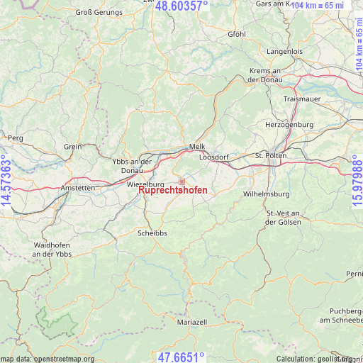
Ruprechtshofen GPS coordinates[2]
48° 8' 11.328" North, 15° 16' 36.3" East
| Map corner | latitude | longitude |
|---|---|---|
| Upper-left | 48.60357°, | 14.57363° |
| Center: | 48.13648°, | 15.27675° |
| Lower-right: | 47.6651°, | 15.97988° |
| Map W x H: | 104.3×104.3 km | = 64.8×64.8mi |
| max Lat: | 48.98333° ⇑25.2% North |
| Ruprechtshofen: | 48.13648° |
| min Lat: | ⇓74.8% South 46.48841° |
| min Long | Ruprechtshofen | max Long |
| 9.57802° | 15.27675° | 17.1° |
| W 59.6%⇐ | ⇒40.4% E |
Elevation
Elevation of Ruprechtshofen is 241 m = 791 ft, and this is 264.5 m = 868 ft below average elevation for this country.
| Max E: |
2140 m = 7021 ft | 86.2% |
| Avg. | 505.5 m = 1658 ft | |
| Ruprechtshofen | 241 m = 791 ft | |
Min E: |
118 m = 387 ft | 13.8% |
See also: Austria elevation on elevation.city.
Geographical zone
Ruprechtshofen is located in North temperate zone (between Tropic of Cancer and the Arctic Circle). Distance of this North polar circle is 2048.9 km =1273.1 mi to North.| Distance of | km | miles | from Ruprechtshofen |
|---|---|---|---|
| North Pole | 4654.8 | 2892.4 | to North |
| Arctic Circle | 2048.9 | 1273.1 | to North |
| Tropic Cancer | 2746.4 | 1706.5 | to South |
| Equator | 5352.3 | 3325.8 | to South |


Nearby cities:
15 places around Ruprechtshofen: (largest is in red/bold)
• Bergland
7.1 km =4.4 mi,  287°
287°
• Erlauf
8.7 km =5.4 mi,  306°
306°
• Golling
9.9 km =6.2 mi,  315°
315°
• Gries bei Oberndorf
9.3 km =5.8 mi,  211°
211°
• Hürm
10.3 km =6.4 mi,  77°
77°
• Kilb
10.5 km =6.5 mi,  111°
111°
• Kirnberg an der Mank
7.9 km =4.9 mi,  154°
154°
• Klein-Pöchlarn
10 km =6.2 mi,  333°
333°
• Mank
5.5 km =3.4 mi,  122°
122°
• Matzleinsdorf
7.1 km =4.4 mi,  353°
353°
• Neuda
10.3 km =6.4 mi, 317°
• Oberndorf an der Melk
9 km =5.6 mi, 205°
• Petzenkirchen
9.1 km =5.7 mi,  277°
277°
• Pöchlarn
9.1 km =5.7 mi, 321°
• Sankt Leonhard am Forst
0.9 km =0.6 mi,  42°
42°
Sources, notices
• [Note1] Compared only with cities in Austria existing in our database
• [Src1] Map data: © OpenStreetMap contributors (CC-BY-SA)
• [Src2] Other city data from geonames.org with taken over terms of usage.
• [Src3] Geographical zone / Annual Mean Temperature by Robert A. Rohde @ Wikipedia
