Pöggstall geodata
Pöggstall (Lower Austria) is a seat of a third-order administrative division; located in Austria in Europe/Vienna (GMT+2) time zone. With population of 929 people, there are 1384 cities with bigger population in this country. Compared to other cities in Austria, 86.7% of cities are located further ↓South; 57.5% of cities are located further ←West and 51% of cities have lower elevation than Pöggstall. Note1
Administrative division(s):
- Level 1: Lower Austria
- Level 2: Politischer Bezirk Melk
- Level 3: Pöggstall


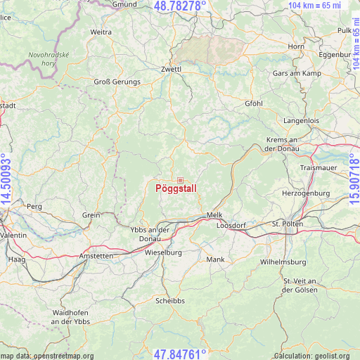
Pöggstall GPS coordinates[2]
48° 19' 2.424" North, 15° 12' 14.58" East
| Map corner | latitude | longitude |
|---|---|---|
| Upper-left | 48.78278°, | 14.50093° |
| Center: | 48.31734°, | 15.20405° |
| Lower-right: | 47.84761°, | 15.90718° |
| Map W x H: | 104×104 km | = 64.6×64.6mi |
| max Lat: | 48.98333° ⇑13.3% North |
| Pöggstall: | 48.31734° |
| min Lat: | ⇓86.7% South 46.48841° |
| min Long | Pöggstall | max Long |
| 9.57802° | 15.20405° | 17.1° |
| W 57.5%⇐ | ⇒42.5% E |
Elevation
Elevation of Pöggstall is 457 m = 1499 ft, and this is 48.5 m = 159 ft below average elevation for this country.
| Max E: |
2140 m = 7021 ft | 49% |
| Avg. | 505.5 m = 1658 ft | |
| Pöggstall | 457 m = 1499 ft | |
Min E: |
118 m = 387 ft | 51% |
See also: Austria elevation on elevation.city.
Geographical zone
Pöggstall is located in North temperate zone (between Tropic of Cancer and the Arctic Circle). Distance of this North polar circle is 2028.8 km =1260.6 mi to North.| Distance of | km | miles | from Pöggstall |
|---|---|---|---|
| North Pole | 4634.7 | 2879.9 | to North |
| Arctic Circle | 2028.8 | 1260.6 | to North |
| Tropic Cancer | 2766.5 | 1719 | to South |
| Equator | 5372.4 | 3338.3 | to South |


Nearby cities:
15 places around Pöggstall: (largest is in red/bold)
• Gutenbrunn
8.2 km =5.1 mi,  310°
310°
• Kirchschlag
8.6 km =5.3 mi,  9°
9°
• Klein-Pöchlarn
11.2 km =7 mi,  175°
175°
• Krummnußbaum an der Donauuferbahn
11.6 km =7.2 mi,  194°
194°
• Laimbach am Ostrong
6.5 km =4 mi,  269°
269°
• Leiben
9.5 km =5.9 mi,  146°
146°
• Marbach an der Donau
11.9 km =7.4 mi,  199°
199°
• Maria Laach am Jauerling
10.5 km =6.5 mi,  98°
98°
• Maria Taferl
10.6 km =6.6 mi, 198°
• Martinsberg
7.6 km =4.7 mi,  328°
328°
• Mühldorf
12.3 km =7.6 mi,  58°
58°
• Ottenschlag
11.9 km =7.4 mi, 5°
• Raxendorf
6 km =3.7 mi, 63°
• Weiten
4.8 km =3 mi,  120°
120°
• Ysper
11 km =6.8 mi,  253°
253°
Sources, notices
• [Note1] Compared only with cities in Austria existing in our database
• [Src1] Map data: © OpenStreetMap contributors (CC-BY-SA)
• [Src2] Other city data from geonames.org with taken over terms of usage.
• [Src3] Geographical zone / Annual Mean Temperature by Robert A. Rohde @ Wikipedia
