Sinabelkirchen geodata
Sinabelkirchen (Styria) is a seat of a third-order administrative division; located in Austria in Europe/Vienna (GMT+2) time zone. With population of 981 people, there are 1321 cities with bigger population in this country. Compared to other cities in Austria, 78.7% of cities are located further ↑North; 75.5% of cities are located further ←West and 73.5% of cities have higher elevation than Sinabelkirchen. Note1
Administrative division(s):
- Level 1: Styria
- Level 2: Politischer Bezirk Weiz
- Level 3: Sinabelkirchen


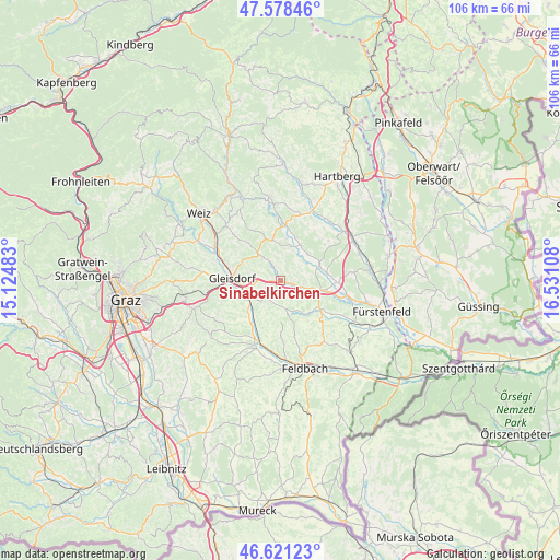
Sinabelkirchen GPS coordinates[2]
47° 6' 7.2" North, 15° 49' 40.62" East
| Map corner | latitude | longitude |
|---|---|---|
| Upper-left | 47.57846°, | 15.12483° |
| Center: | 47.102°, | 15.82795° |
| Lower-right: | 46.62123°, | 16.53108° |
| Map W x H: | 106.4×106.4 km | = 66.1×66.1mi |
| max Lat: | 48.98333° ⇑78.7% North |
| Sinabelkirchen: | 47.102° |
| min Lat: | ⇓21.3% South 46.48841° |
| min Long | Sinabelkirchen | max Long |
| 9.57802° | 15.82795° | 17.1° |
| W 75.5%⇐ | ⇒24.5% E |
Elevation
Elevation of Sinabelkirchen is 311 m = 1020 ft, and this is 194.5 m = 638 ft below average elevation for this country.
| Max E: |
2140 m = 7021 ft | 73.5% |
| Avg. | 505.5 m = 1658 ft | |
| Sinabelkirchen | 311 m = 1020 ft | |
Min E: |
118 m = 387 ft | 26.5% |
See also: Austria elevation on elevation.city.
Geographical zone
Sinabelkirchen is located in North temperate zone (between Tropic of Cancer and the Arctic Circle). Distance of this North polar circle is 2163.9 km =1344.6 mi to North.| Distance of | km | miles | from Sinabelkirchen |
|---|---|---|---|
| North Pole | 4769.8 | 2963.8 | to North |
| Arctic Circle | 2163.9 | 1344.6 | to North |
| Tropic Cancer | 2631.3 | 1635 | to South |
| Equator | 5237.3 | 3254.3 | to South |


Nearby cities:
15 places around Sinabelkirchen: (largest is in red/bold)
• Egelsdorf
1.8 km =1.1 mi,  332°
332°
• Gersdorf an der Feistritz
7.4 km =4.6 mi,  13°
13°
• Gnies
1.7 km =1.1 mi,  97°
97°
• Grosssteinbach
6.8 km =4.2 mi,  38°
38°
• Hartmannsdorf
5.3 km =3.3 mi,  170°
170°
• Hofstätten an der Raab
8.2 km =5.1 mi,  241°
241°
• Ilz
7.7 km =4.8 mi, 102°
• Nestelbach im Ilztal
3.6 km =2.2 mi,  125°
125°
• Nitscha
6.1 km =3.8 mi,  285°
285°
• Oberrettenbach
5.7 km =3.5 mi,  338°
338°
• Ottendorf an der Rittschein
8.1 km =5 mi,  139°
139°
• Prebensdorf
4.9 km =3 mi,  315°
315°
• Pöllau bei Gleisdorf
4.5 km =2.8 mi,  208°
208°
• Sulz bei Gleisdorf
8.2 km =5.1 mi, 241°
• Untergroßau
1.3 km =0.8 mi,  267°
267°
Sources, notices
• [Note1] Compared only with cities in Austria existing in our database
• [Src1] Map data: © OpenStreetMap contributors (CC-BY-SA)
• [Src2] Other city data from geonames.org with taken over terms of usage.
• [Src3] Geographical zone / Annual Mean Temperature by Robert A. Rohde @ Wikipedia
