Anger geodata
Anger (Styria) is a seat of a third-order administrative division; located in Austria in Europe/Vienna (GMT+2) time zone. With population of 854 people, there are 1511 cities with bigger population in this country. Compared to other cities in Austria, 67.6% of cities are located further ↑North; 71.8% of cities are located further ←West and 53.2% of cities have lower elevation than Anger. Note1


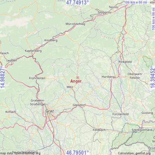
Anger GPS coordinates[2]
47° 16' 27.192" North, 15° 41' 29.004" East
| Map corner | latitude | longitude |
|---|---|---|
| Upper-left | 47.74913°, | 14.98827° |
| Center: | 47.27422°, | 15.69139° |
| Lower-right: | 46.79501°, | 16.39452° |
| Map W x H: | 106.1×106.1 km | = 65.9×65.9mi |
| max Lat: | 48.98333° ⇑67.6% North |
| Anger: | 47.27422° |
| min Lat: | ⇓32.4% South 46.48841° |
| min Long | Anger | max Long |
| 9.57802° | 15.69139° | 17.1° |
| W 71.8%⇐ | ⇒28.2% E |
Elevation
Elevation of Anger is 473 m = 1552 ft, and this is 32.5 m = 107 ft below average elevation for this country.
| Max E: |
2140 m = 7021 ft | 46.8% |
| Avg. | 505.5 m = 1658 ft | |
| Anger | 473 m = 1552 ft | |
Min E: |
118 m = 387 ft | 53.2% |
See also: Austria elevation on elevation.city.
Geographical zone
Anger is located in North temperate zone (between Tropic of Cancer and the Arctic Circle). Distance of this North polar circle is 2144.8 km =1332.7 mi to North.| Distance of | km | miles | from Anger |
|---|---|---|---|
| North Pole | 4750.7 | 2951.9 | to North |
| Arctic Circle | 2144.8 | 1332.7 | to North |
| Tropic Cancer | 2650.5 | 1646.9 | to South |
| Equator | 5256.4 | 3266.2 | to South |


Nearby cities:
15 places around Anger: (largest is in red/bold)
• Affental
8.7 km =5.4 mi,  244°
244°
• Baierdorf-Umgebung
1.9 km =1.2 mi,  49°
49°
• Birkfeld
8.4 km =5.2 mi,  355°
355°
• Etzersdorf
8.3 km =5.2 mi,  184°
184°
• Floing
4.3 km =2.7 mi,  105°
105°
• Gschaid bei Birkfeld
8.7 km =5.4 mi,  5°
5°
• Landscha bei Weiz
8.5 km =5.3 mi,  221°
221°
• Naas
7.8 km =4.8 mi,  250°
250°
• Oberfeistritz
2.8 km =1.7 mi,  166°
166°
• Obersaifen
8.4 km =5.2 mi,  55°
55°
• Puch bei Weiz
6.7 km =4.2 mi,  163°
163°
• Sankt Kathrein am Offenegg
8.6 km =5.3 mi,  289°
289°
• Sankt Kathrein am Offenegg I Viertel
8.6 km =5.3 mi, 287°
• Weiz
8.5 km =5.3 mi, 221°
• Zeil
7.4 km =4.6 mi, 111°
Sources, notices
• [Note1] Compared only with cities in Austria existing in our database
• [Src1] Map data: © OpenStreetMap contributors (CC-BY-SA)
• [Src2] Other city data from geonames.org with taken over terms of usage.
• [Src3] Geographical zone / Annual Mean Temperature by Robert A. Rohde @ Wikipedia
