Waisenegg geodata
Waisenegg (Styria) is a populated place; located in Austria in Europe/Vienna (GMT+2) time zone. With population of 738 people, there are 1753 cities with bigger population in this country. Compared to other cities in Austria, 60% of cities are located further ↑North; 71.5% of cities are located further ←West and 81.6% of cities have lower elevation than Waisenegg. Note1


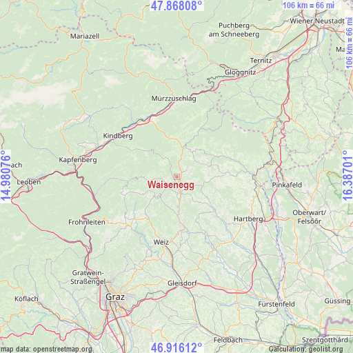
Waisenegg GPS coordinates[2]
47° 23' 39.3" North, 15° 41' 1.968" East
| Map corner | latitude | longitude |
|---|---|---|
| Upper-left | 47.86808°, | 14.98076° |
| Center: | 47.39425°, | 15.68388° |
| Lower-right: | 46.91612°, | 16.38701° |
| Map W x H: | 105.8×105.8 km | = 65.7×65.7mi |
| max Lat: | 48.98333° ⇑60% North |
| Waisenegg: | 47.39425° |
| min Lat: | ⇓40% South 46.48841° |
| min Long | Waisenegg | max Long |
| 9.57802° | 15.68388° | 17.1° |
| W 71.5%⇐ | ⇒28.5% E |
Elevation
Elevation of Waisenegg is 747 m = 2451 ft, and this is 241.5 m = 792 ft above average elevation for this country.
| Max E: |
2140 m = 7021 ft | 18.4% |
| Waisenegg | 747 m 2451 ft | |
| Avg. | 505.5 m = 1658 ft | |
Min E: |
118 m = 387 ft | 81.6% |
See also: Austria elevation on elevation.city.
Geographical zone
Waisenegg is located in North temperate zone (between Tropic of Cancer and the Arctic Circle). Distance of this North polar circle is 2131.4 km =1324.4 mi to North.| Distance of | km | miles | from Waisenegg |
|---|---|---|---|
| North Pole | 4737.3 | 2943.6 | to North |
| Arctic Circle | 2131.4 | 1324.4 | to North |
| Tropic Cancer | 2663.8 | 1655.2 | to South |
| Equator | 5269.7 | 3274.4 | to South |


Nearby cities:
15 places around Waisenegg: (largest is in red/bold)
• Birkfeld
4.9 km =3 mi,  180°
180°
• Falkenstein
6.2 km =3.9 mi,  359°
359°
• Fischbach
5.9 km =3.7 mi,  334°
334°
• Gasen
8.9 km =5.5 mi,  262°
262°
• Gschaid bei Birkfeld
4.9 km =3 mi,  163°
163°
• Kirchenviertel
10.5 km =6.5 mi,  15°
15°
• Miesenbach bei Birkfeld
6.9 km =4.3 mi,  116°
116°
• Obersaifen
11.4 km =7.1 mi,  139°
139°
• Pittermann
7.9 km =4.9 mi,  71°
71°
• Prätis
11.1 km =6.9 mi, 119°
• Ratten
10.2 km =6.3 mi,  13°
13°
• Sankt Jakob im Walde
11 km =6.8 mi,  42°
42°
• Sankt Kathrein am Hauenstein
10.6 km =6.6 mi,  4°
4°
• Strallegg
3.7 km =2.3 mi,  58°
58°
• Vornholz
10.7 km =6.6 mi,  88°
88°
Sources, notices
• [Note1] Compared only with cities in Austria existing in our database
• [Src1] Map data: © OpenStreetMap contributors (CC-BY-SA)
• [Src2] Other city data from geonames.org with taken over terms of usage.
• [Src3] Geographical zone / Annual Mean Temperature by Robert A. Rohde @ Wikipedia
