Echsenbach geodata
Echsenbach (Lower Austria) is a seat of a third-order administrative division; located in Austria in Europe/Vienna (GMT+2) time zone. With population of 777 people, there are 1662 cities with bigger population in this country. Compared to other cities in Austria, 98.4% of cities are located further ↓South; 57.8% of cities are located further ←West and 65.4% of cities have lower elevation than Echsenbach. Note1
Administrative division(s):
- Level 1: Lower Austria
- Level 2: Politischer Bezirk Zwettl
- Level 3: Echsenbach


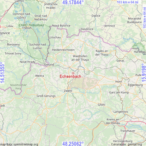
Echsenbach GPS coordinates[2]
48° 43' 0.012" North, 15° 13' 0.012" East
| Map corner | latitude | longitude |
|---|---|---|
| Upper-left | 49.17844°, | 14.51355° |
| Center: | 48.71667°, | 15.21667° |
| Lower-right: | 48.25062°, | 15.9198° |
| Map W x H: | 103.2×103.2 km | = 64.1×64.1mi |
| max Lat: | 48.98333° ⇑1.6% North |
| Echsenbach: | 48.71667° |
| min Lat: | ⇓98.4% South 46.48841° |
| min Long | Echsenbach | max Long |
| 9.57802° | 15.21667° | 17.1° |
| W 57.8%⇐ | ⇒42.2% E |
Elevation
Elevation of Echsenbach is 555 m = 1821 ft, and this is 49.5 m = 162 ft above average elevation for this country.
| Max E: |
2140 m = 7021 ft | 34.6% |
| Echsenbach | 555 m 1821 ft | |
| Avg. | 505.5 m = 1658 ft | |
Min E: |
118 m = 387 ft | 65.4% |
See also: Austria elevation on elevation.city.
Geographical zone
Echsenbach is located in North temperate zone (between Tropic of Cancer and the Arctic Circle). Distance of this North polar circle is 1984.4 km =1233 mi to North.| Distance of | km | miles | from Echsenbach |
|---|---|---|---|
| North Pole | 4590.3 | 2852.3 | to North |
| Arctic Circle | 1984.4 | 1233 | to North |
| Tropic Cancer | 2810.9 | 1746.6 | to South |
| Equator | 5416.8 | 3365.8 | to South |


Nearby cities:
15 places around Echsenbach: (largest is in red/bold)
• Allentsteig
8.4 km =5.2 mi,  104°
104°
• Alt-Dietmanns
14.9 km =9.3 mi,  55°
55°
• Göpfritz an der Wild
13.7 km =8.5 mi,  86°
86°
• Hirschbach
7.3 km =4.5 mi,  293°
293°
• Hoheneich
15.1 km =9.4 mi, 294°
• Kirchberg am Walde
9.5 km =5.9 mi,  275°
275°
• Rudmanns
12.7 km =7.9 mi,  183°
183°
• Schrems
13.3 km =8.3 mi,  303°
303°
• Schwarzenau
4.3 km =2.7 mi,  44°
44°
• Schweiggers
12.3 km =7.6 mi,  243°
243°
• Vitis
5.4 km =3.4 mi,  332°
332°
• Waidhofen an der Thaya
12.1 km =7.5 mi,  23°
23°
• Waldenstein
14.9 km =9.3 mi, 275°
• Windigsteig
7.4 km =4.6 mi, 41°
• Zwettl Stadt
12.7 km =7.9 mi,  196°
196°
Sources, notices
• [Note1] Compared only with cities in Austria existing in our database
• [Src1] Map data: © OpenStreetMap contributors (CC-BY-SA)
• [Src2] Other city data from geonames.org with taken over terms of usage.
• [Src3] Geographical zone / Annual Mean Temperature by Robert A. Rohde @ Wikipedia
