Göpfritz an der Wild geodata
Göpfritz an der Wild (Lower Austria) is a seat of a third-order administrative division; located in Austria in Europe/Vienna (GMT+2) time zone. With population of 770 people, there are 1677 cities with bigger population in this country. Compared to other cities in Austria, 98.7% of cities are located further ↓South; 62.8% of cities are located further ←West and 69.2% of cities have lower elevation than Göpfritz an der Wild. Note1
Administrative division(s):
- Level 1: Lower Austria
- Level 2: Politischer Bezirk Zwettl
- Level 3: Göpfritz an der Wild


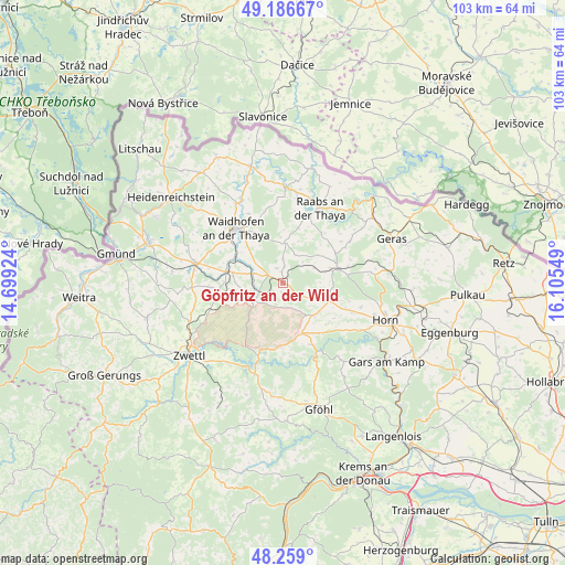
Göpfritz an der Wild GPS coordinates[2]
48° 43' 29.892" North, 15° 24' 8.496" East
| Map corner | latitude | longitude |
|---|---|---|
| Upper-left | 49.18667°, | 14.69924° |
| Center: | 48.72497°, | 15.40236° |
| Lower-right: | 48.259°, | 16.10549° |
| Map W x H: | 103.1×103.1 km | = 64.1×64.1mi |
| max Lat: | 48.98333° ⇑1.3% North |
| Göpfritz an der Wild: | 48.72497° |
| min Lat: | ⇓98.7% South 46.48841° |
| min Long | Göpfritz an de | max Long |
| 9.57802° | 15.40236° | 17.1° |
| W 62.8%⇐ | ⇒37.2% E |
Elevation
Elevation of Göpfritz an der Wild is 582 m = 1909 ft, and this is 76.5 m = 251 ft above average elevation for this country.
| Max E: |
2140 m = 7021 ft | 30.8% |
| Göpfritz an der Wild | 582 m 1909 ft | |
| Avg. | 505.5 m = 1658 ft | |
Min E: |
118 m = 387 ft | 69.2% |
See also: Austria elevation on elevation.city.
Geographical zone
Göpfritz an der Wild is located in North temperate zone (between Tropic of Cancer and the Arctic Circle). Distance of this North polar circle is 1983.5 km =1232.5 mi to North.| Distance of | km | miles | from Göpfritz an der Wild |
|---|---|---|---|
| North Pole | 4589.4 | 2851.7 | to North |
| Arctic Circle | 1983.5 | 1232.5 | to North |
| Tropic Cancer | 2811.8 | 1747.2 | to South |
| Equator | 5417.7 | 3366.4 | to South |


Nearby cities:
15 places around Göpfritz an der Wild: (largest is in red/bold)
• Allentsteig
6.3 km =3.9 mi,  240°
240°
• Alt-Dietmanns
7.6 km =4.7 mi,  349°
349°
• Altenburg
16.4 km =10.2 mi,  121°
121°
• Brunn an der Wild
9.3 km =5.8 mi,  111°
111°
• Echsenbach
13.7 km =8.5 mi,  266°
266°
• Groß-Siegharts
7.4 km =4.6 mi,  1°
1°
• Japons
14.3 km =8.9 mi,  58°
58°
• Krumau am Kamp
15.5 km =9.6 mi,  167°
167°
• Pernegg
15.7 km =9.8 mi,  86°
86°
• Raabs an der Thaya
15.6 km =9.7 mi,  27°
27°
• Röhrenbach
11 km =6.8 mi,  139°
139°
• Schwarzenau
10.8 km =6.7 mi,  281°
281°
• Vitis
16.6 km =10.3 mi, 283°
• Waidhofen an der Thaya
13.4 km =8.3 mi,  319°
319°
• Windigsteig
9.9 km =6.2 mi,  297°
297°
Sources, notices
• [Note1] Compared only with cities in Austria existing in our database
• [Src1] Map data: © OpenStreetMap contributors (CC-BY-SA)
• [Src2] Other city data from geonames.org with taken over terms of usage.
• [Src3] Geographical zone / Annual Mean Temperature by Robert A. Rohde @ Wikipedia
