Schwarzenau geodata
Schwarzenau (Lower Austria) is a seat of a third-order administrative division; located in Austria in Europe/Vienna (GMT+2) time zone. With population of 858 people, there are 1503 cities with bigger population in this country. Compared to other cities in Austria, 98.9% of cities are located further ↓South; 58.9% of cities are located further ←West and 57.1% of cities have lower elevation than Schwarzenau. Note1
Administrative division(s):
- Level 1: Lower Austria
- Level 2: Politischer Bezirk Zwettl
- Level 3: Schwarzenau


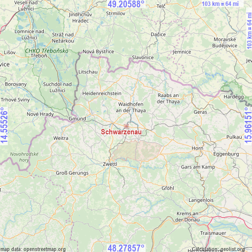
Schwarzenau GPS coordinates[2]
48° 44' 39.696" North, 15° 15' 30.168" East
| Map corner | latitude | longitude |
|---|---|---|
| Upper-left | 49.20588°, | 14.55526° |
| Center: | 48.74436°, | 15.25838° |
| Lower-right: | 48.27857°, | 15.96151° |
| Map W x H: | 103.1×103.1 km | = 64.1×64.1mi |
| max Lat: | 48.98333° ⇑1.1% North |
| Schwarzenau: | 48.74436° |
| min Lat: | ⇓98.9% South 46.48841° |
| min Long | Schwarzenau | max Long |
| 9.57802° | 15.25838° | 17.1° |
| W 58.9%⇐ | ⇒41.1% E |
Elevation
Elevation of Schwarzenau is 499 m = 1637 ft, and this is 6.5 m = 21 ft below average elevation for this country.
| Max E: |
2140 m = 7021 ft | 42.9% |
| Avg. | 505.5 m = 1658 ft | |
| Schwarzenau | 499 m = 1637 ft | |
Min E: |
118 m = 387 ft | 57.1% |
See also: Austria elevation on elevation.city.
Geographical zone
Schwarzenau is located in North temperate zone (between Tropic of Cancer and the Arctic Circle). Distance of this North polar circle is 1981.3 km =1231.1 mi to North.| Distance of | km | miles | from Schwarzenau |
|---|---|---|---|
| North Pole | 4587.2 | 2850.4 | to North |
| Arctic Circle | 1981.3 | 1231.1 | to North |
| Tropic Cancer | 2813.9 | 1748.5 | to South |
| Equator | 5419.9 | 3367.8 | to South |


Nearby cities:
15 places around Schwarzenau: (largest is in red/bold)
• Allentsteig
7.3 km =4.5 mi,  135°
135°
• Alt-Dietmanns
10.7 km =6.6 mi,  59°
59°
• Amaliendorf
16.2 km =10.1 mi,  307°
307°
• Echsenbach
4.3 km =2.7 mi,  224°
224°
• Groß-Siegharts
11.9 km =7.4 mi, 63°
• Göpfritz an der Wild
10.8 km =6.7 mi,  101°
101°
• Hirschbach
9.8 km =6.1 mi,  269°
269°
• Kirchberg am Walde
12.7 km =7.9 mi,  260°
260°
• Rudmanns
16.2 km =10.1 mi,  193°
193°
• Schrems
14.7 km =9.1 mi,  287°
287°
• Schweiggers
16.5 km =10.3 mi,  238°
238°
• Thaya
12.5 km =7.8 mi,  10°
10°
• Vitis
5.8 km =3.6 mi, 287°
• Waidhofen an der Thaya
8.2 km =5.1 mi, 12°
• Windigsteig
3.1 km =1.9 mi,  36°
36°
Sources, notices
• [Note1] Compared only with cities in Austria existing in our database
• [Src1] Map data: © OpenStreetMap contributors (CC-BY-SA)
• [Src2] Other city data from geonames.org with taken over terms of usage.
• [Src3] Geographical zone / Annual Mean Temperature by Robert A. Rohde @ Wikipedia
