Zwettl Stadt geodata
Zwettl Stadt (Lower Austria) is a seat of a second-order administrative division; located in Austria in Europe/Vienna (GMT+2) time zone. With population of 3,900 people, there are 267 cities with bigger population in this country. Compared to other cities in Austria, 96.9% of cities are located further ↓South; 57.2% of cities are located further ←West and 62.7% of cities have lower elevation than Zwettl Stadt. Note1
Administrative division(s):
- Level 1: Lower Austria
- Level 2: Politischer Bezirk Zwettl
- Level 3: Zwettl-Niederösterreich


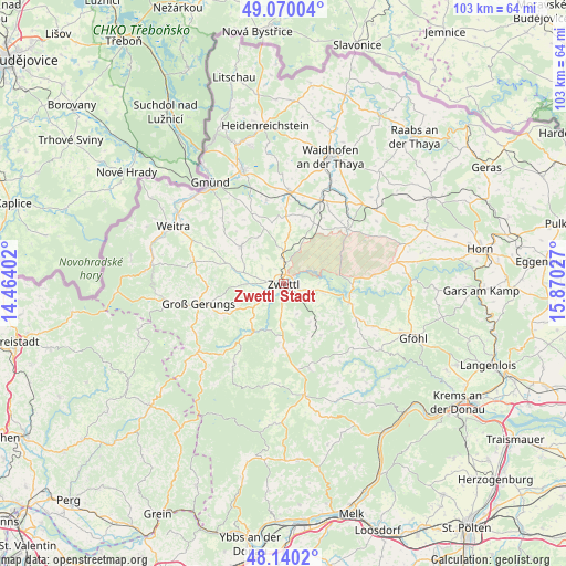
Zwettl Stadt GPS coordinates[2]
48° 36' 26.136" North, 15° 10' 1.704" East
| Map corner | latitude | longitude |
|---|---|---|
| Upper-left | 49.07004°, | 14.46402° |
| Center: | 48.60726°, | 15.16714° |
| Lower-right: | 48.1402°, | 15.87027° |
| Map W x H: | 103.4×103.4 km | = 64.2×64.2mi |
| max Lat: | 48.98333° ⇑3.1% North |
| Zwettl Stadt: | 48.60726° |
| min Lat: | ⇓96.9% South 46.48841° |
| min Long | Zwettl Stadt | max Long |
| 9.57802° | 15.16714° | 17.1° |
| W 57.2%⇐ | ⇒42.8% E |
Elevation
Elevation of Zwettl Stadt is 537 m = 1762 ft, and this is 31.5 m = 103 ft above average elevation for this country.
| Max E: |
2140 m = 7021 ft | 37.3% |
| Zwettl Stadt | 537 m 1762 ft | |
| Avg. | 505.5 m = 1658 ft | |
Min E: |
118 m = 387 ft | 62.7% |
See also: Austria elevation on elevation.city.
Geographical zone
Zwettl Stadt is located in North temperate zone (between Tropic of Cancer and the Arctic Circle). Distance of this North polar circle is 1996.6 km =1240.6 mi to North.| Distance of | km | miles | from Zwettl Stadt |
|---|---|---|---|
| North Pole | 4602.4 | 2859.8 | to North |
| Arctic Circle | 1996.6 | 1240.6 | to North |
| Tropic Cancer | 2798.7 | 1739 | to South |
| Equator | 5404.6 | 3358.3 | to South |


Nearby cities:
15 places around Zwettl Stadt: (largest is in red/bold)
• Allentsteig
15.5 km =9.6 mi,  49°
49°
• Echsenbach
12.7 km =7.9 mi,  16°
16°
• Grafenschlag
11.9 km =7.4 mi,  180°
180°
• Groß-Gerungs
15.8 km =9.8 mi,  256°
256°
• Hirschbach
15.4 km =9.6 mi,  348°
348°
• Kirchberg am Walde
14.3 km =8.9 mi,  336°
336°
• Rappottenstein
11.5 km =7.1 mi,  214°
214°
• Rastenfeld
12.7 km =7.9 mi,  107°
107°
• Rudmanns
2.9 km =1.8 mi,  99°
99°
• Sallingberg
16.4 km =10.2 mi,  162°
162°
• Schwarzenau
16.7 km =10.4 mi, 23°
• Schweiggers
9.9 km =6.2 mi,  311°
311°
• Vitis
17 km =10.6 mi,  3°
3°
• Waldenstein
17.5 km =10.9 mi,  320°
320°
• Waldhausen
11.8 km =7.3 mi,  143°
143°
Sources, notices
• [Note1] Compared only with cities in Austria existing in our database
• [Src1] Map data: © OpenStreetMap contributors (CC-BY-SA)
• [Src2] Other city data from geonames.org with taken over terms of usage.
• [Src3] Geographical zone / Annual Mean Temperature by Robert A. Rohde @ Wikipedia
