Rudmanns geodata
Rudmanns (Lower Austria) is a populated place; located in Austria in Europe/Vienna (GMT+2) time zone. With population of 593 people, there are 2161 cities with bigger population in this country. Compared to other cities in Austria, 96.8% of cities are located further ↓South; 57.5% of cities are located further ←West and 65.6% of cities have lower elevation than Rudmanns. Note1
Administrative division(s):
- Level 1: Lower Austria
- Level 2: Politischer Bezirk Zwettl
- Level 3: Zwettl-Niederösterreich


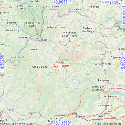
Rudmanns GPS coordinates[2]
48° 36' 10.404" North, 15° 12' 20.448" East
| Map corner | latitude | longitude |
|---|---|---|
| Upper-left | 49.06571°, | 14.50256° |
| Center: | 48.60289°, | 15.20568° |
| Lower-right: | 48.13579°, | 15.90881° |
| Map W x H: | 103.4×103.4 km | = 64.2×64.2mi |
| max Lat: | 48.98333° ⇑3.2% North |
| Rudmanns: | 48.60289° |
| min Lat: | ⇓96.8% South 46.48841° |
| min Long | Rudmanns | max Long |
| 9.57802° | 15.20568° | 17.1° |
| W 57.5%⇐ | ⇒42.5% E |
Elevation
Elevation of Rudmanns is 556 m = 1824 ft, and this is 50.5 m = 166 ft above average elevation for this country.
| Max E: |
2140 m = 7021 ft | 34.4% |
| Rudmanns | 556 m 1824 ft | |
| Avg. | 505.5 m = 1658 ft | |
Min E: |
118 m = 387 ft | 65.6% |
See also: Austria elevation on elevation.city.
Geographical zone
Rudmanns is located in North temperate zone (between Tropic of Cancer and the Arctic Circle). Distance of this North polar circle is 1997 km =1240.9 mi to North.| Distance of | km | miles | from Rudmanns |
|---|---|---|---|
| North Pole | 4602.9 | 2860.1 | to North |
| Arctic Circle | 1997 | 1240.9 | to North |
| Tropic Cancer | 2798.2 | 1738.7 | to South |
| Equator | 5404.1 | 3358 | to South |


Nearby cities:
15 places around Rudmanns: (largest is in red/bold)
• Allentsteig
13.8 km =8.6 mi,  40°
40°
• Echsenbach
12.7 km =7.9 mi,  3°
3°
• Grafenschlag
11.8 km =7.3 mi,  194°
194°
• Groß-Gerungs
18.5 km =11.5 mi,  260°
260°
• Hirschbach
16.7 km =10.4 mi,  339°
339°
• Kirchberg am Walde
16.1 km =10 mi,  327°
327°
• Krumau am Kamp
18 km =11.2 mi,  95°
95°
• Rappottenstein
13 km =8.1 mi,  225°
225°
• Rastenfeld
9.8 km =6.1 mi,  109°
109°
• Sallingberg
15.3 km =9.5 mi,  172°
172°
• Schwarzenau
16.2 km =10.1 mi,  13°
13°
• Schweiggers
12.4 km =7.7 mi,  304°
304°
• Vitis
17.5 km =10.9 mi,  354°
354°
• Waldhausen
9.9 km =6.2 mi,  155°
155°
• Zwettl Stadt
2.9 km =1.8 mi,  279°
279°
Sources, notices
• [Note1] Compared only with cities in Austria existing in our database
• [Src1] Map data: © OpenStreetMap contributors (CC-BY-SA)
• [Src2] Other city data from geonames.org with taken over terms of usage.
• [Src3] Geographical zone / Annual Mean Temperature by Robert A. Rohde @ Wikipedia
