Altmelon geodata
Altmelon (Lower Austria) is a seat of a third-order administrative division; located in Austria in Europe/Vienna (GMT+2) time zone. With population of 302 people, there are 2735 cities with bigger population in this country. Compared to other cities in Austria, 93.1% of cities are located further ↓South; 53.8% of cities are located further ←West and 90.1% of cities have lower elevation than Altmelon. Note1
Administrative division(s):
- Level 1: Lower Austria
- Level 2: Politischer Bezirk Zwettl
- Level 3: Altmelon


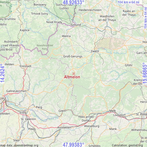
Altmelon GPS coordinates[2]
48° 27' 43.992" North, 14° 57' 55.872" East
| Map corner | latitude | longitude |
|---|---|---|
| Upper-left | 48.92633°, | 14.2624° |
| Center: | 48.46222°, | 14.96552° |
| Lower-right: | 47.99383°, | 15.66865° |
| Map W x H: | 103.7×103.7 km | = 64.4×64.4mi |
| max Lat: | 48.98333° ⇑6.9% North |
| Altmelon: | 48.46222° |
| min Lat: | ⇓93.1% South 46.48841° |
| min Long | Altmelon | max Long |
| 9.57802° | 14.96552° | 17.1° |
| W 53.8%⇐ | ⇒46.2% E |
Elevation
Elevation of Altmelon is 884 m = 2900 ft, and this is 378.5 m = 1242 ft above average elevation for this country.
| Max E: |
2140 m = 7021 ft | 9.9% |
| Altmelon | 884 m 2900 ft | |
| Avg. | 505.5 m = 1658 ft | |
Min E: |
118 m = 387 ft | 90.1% |
See also: Austria elevation on elevation.city.
Geographical zone
Altmelon is located in North temperate zone (between Tropic of Cancer and the Arctic Circle). Distance of this North polar circle is 2012.7 km =1250.6 mi to North.| Distance of | km | miles | from Altmelon |
|---|---|---|---|
| North Pole | 4618.6 | 2869.9 | to North |
| Arctic Circle | 2012.7 | 1250.6 | to North |
| Tropic Cancer | 2782.6 | 1729 | to South |
| Equator | 5388.5 | 3348.3 | to South |


Nearby cities:
15 places around Altmelon: (largest is in red/bold)
• Arbesbach
3.6 km =2.2 mi,  345°
345°
• Bad Traunstein
11.5 km =7.1 mi,  103°
103°
• Bärnkopf
8.5 km =5.3 mi,  160°
160°
• Dorfstetten
15.2 km =9.4 mi,  175°
175°
• Grafenschlag
15.4 km =9.6 mi,  74°
74°
• Groß-Gerungs
12.5 km =7.8 mi,  357°
357°
• Gutenbrunn
15.6 km =9.7 mi,  133°
133°
• Königswiesen
11.4 km =7.1 mi,  235°
235°
• Langschlag
13.8 km =8.6 mi,  334°
334°
• Martinsberg
16.7 km =10.4 mi, 125°
• Mönchdorf
17 km =10.6 mi,  228°
228°
• Rappottenstein
10.7 km =6.6 mi,  51°
51°
• Sankt Georgen am Walde
12.3 km =7.6 mi,  202°
202°
• Schönbach
5.2 km =3.2 mi,  105°
105°
• Unterweissenbach
13.8 km =8.6 mi,  257°
257°
Sources, notices
• [Note1] Compared only with cities in Austria existing in our database
• [Src1] Map data: © OpenStreetMap contributors (CC-BY-SA)
• [Src2] Other city data from geonames.org with taken over terms of usage.
• [Src3] Geographical zone / Annual Mean Temperature by Robert A. Rohde @ Wikipedia
