Sankt Georgen am Walde geodata
Sankt Georgen am Walde (Upper Austria) is a populated place; located in Austria in Europe/Vienna (GMT+2) time zone. With population of 567 people, there are 2257 cities with bigger population in this country. Compared to other cities in Austria, 88.9% of cities are located further ↓South; 53.3% of cities are located further ←West and 85.5% of cities have lower elevation than Sankt Georgen am Walde. Note1
Administrative division(s):
- Level 1: Upper Austria
- Level 2: Politischer Bezirk Perg
- Level 3: Sankt Georgen am Walde


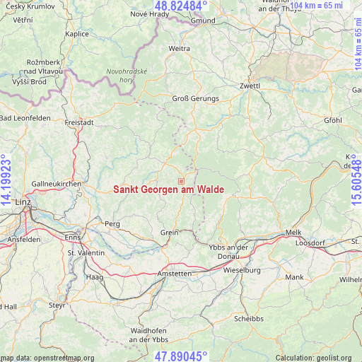
Sankt Georgen am Walde GPS coordinates[2]
48° 21' 35.244" North, 14° 54' 8.46" East
| Map corner | latitude | longitude |
|---|---|---|
| Upper-left | 48.82484°, | 14.19923° |
| Center: | 48.35979°, | 14.90235° |
| Lower-right: | 47.89045°, | 15.60548° |
| Map W x H: | 103.9×103.9 km | = 64.6×64.6mi |
| max Lat: | 48.98333° ⇑11.1% North |
| Sankt Georgen am Walde: | 48.35979° |
| min Lat: | ⇓88.9% South 46.48841° |
| min Long | Sankt Georgen a | max Long |
| 9.57802° | 14.90235° | 17.1° |
| W 53.3%⇐ | ⇒46.7% E |
Elevation
Elevation of Sankt Georgen am Walde is 802 m = 2631 ft, and this is 296.5 m = 973 ft above average elevation for this country.
| Max E: |
2140 m = 7021 ft | 14.5% |
| Sankt Georgen am Walde | 802 m 2631 ft | |
| Avg. | 505.5 m = 1658 ft | |
Min E: |
118 m = 387 ft | 85.5% |
See also: Austria elevation on elevation.city.
Geographical zone
Sankt Georgen am Walde is located in North temperate zone (between Tropic of Cancer and the Arctic Circle). Distance of this North polar circle is 2024.1 km =1257.7 mi to North.| Distance of | km | miles | from Sankt Georgen am Walde |
|---|---|---|---|
| North Pole | 4630 | 2876.9 | to North |
| Arctic Circle | 2024.1 | 1257.7 | to North |
| Tropic Cancer | 2771.2 | 1721.9 | to South |
| Equator | 5377.1 | 3341.2 | to South |


Nearby cities:
15 places around Sankt Georgen am Walde: (largest is in red/bold)
• Altmelon
12.3 km =7.6 mi,  22°
22°
• Arbesbach
15.3 km =9.5 mi,  14°
14°
• Bad Kreuzen
12.5 km =7.8 mi,  214°
214°
• Bärnkopf
8.3 km =5.2 mi,  65°
65°
• Dorfstetten
7 km =4.3 mi,  122°
122°
• Grein
14.9 km =9.3 mi,  192°
192°
• Königswiesen
6.9 km =4.3 mi,  316°
316°
• Mönchdorf
8 km =5 mi,  270°
270°
• Pabneukirchen
7.4 km =4.6 mi,  237°
237°
• Pierbach
10.9 km =6.8 mi,  263°
263°
• Schönau im Mühlkreis
13.3 km =8.3 mi,  286°
286°
• Schönbach
13.9 km =8.6 mi,  43°
43°
• Unterweissenbach
12.2 km =7.6 mi,  313°
313°
• Waldhausen im Strudengau
10.1 km =6.3 mi,  160°
160°
• Ysper
14.2 km =8.8 mi, 123°
Sources, notices
• [Note1] Compared only with cities in Austria existing in our database
• [Src1] Map data: © OpenStreetMap contributors (CC-BY-SA)
• [Src2] Other city data from geonames.org with taken over terms of usage.
• [Src3] Geographical zone / Annual Mean Temperature by Robert A. Rohde @ Wikipedia
