Grafenschlag geodata
Grafenschlag (Lower Austria) is a seat of a third-order administrative division; located in Austria in Europe/Vienna (GMT+2) time zone. With population of 389 people, there are 2632 cities with bigger population in this country. Compared to other cities in Austria, 94.3% of cities are located further ↓South; 57% of cities are located further ←West and 83.8% of cities have lower elevation than Grafenschlag. Note1
Administrative division(s):
- Level 1: Lower Austria
- Level 2: Politischer Bezirk Zwettl
- Level 3: Grafenschlag


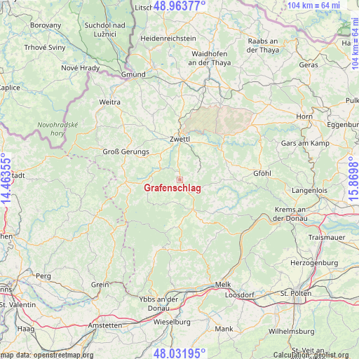
Grafenschlag GPS coordinates[2]
48° 30' 0" North, 15° 10' 0.012" East
| Map corner | latitude | longitude |
|---|---|---|
| Upper-left | 48.96377°, | 14.46355° |
| Center: | 48.5°, | 15.16667° |
| Lower-right: | 48.03195°, | 15.8698° |
| Map W x H: | 103.6×103.6 km | = 64.4×64.4mi |
| max Lat: | 48.98333° ⇑5.7% North |
| Grafenschlag: | 48.5° |
| min Lat: | ⇓94.3% South 46.48841° |
| min Long | Grafenschlag | max Long |
| 9.57802° | 15.16667° | 17.1° |
| W 57%⇐ | ⇒43% E |
Elevation
Elevation of Grafenschlag is 780 m = 2559 ft, and this is 274.5 m = 901 ft above average elevation for this country.
| Max E: |
2140 m = 7021 ft | 16.2% |
| Grafenschlag | 780 m 2559 ft | |
| Avg. | 505.5 m = 1658 ft | |
Min E: |
118 m = 387 ft | 83.8% |
See also: Austria elevation on elevation.city.
Geographical zone
Grafenschlag is located in North temperate zone (between Tropic of Cancer and the Arctic Circle). Distance of this North polar circle is 2008.5 km =1248 mi to North.| Distance of | km | miles | from Grafenschlag |
|---|---|---|---|
| North Pole | 4614.4 | 2867.3 | to North |
| Arctic Circle | 2008.5 | 1248 | to North |
| Tropic Cancer | 2786.8 | 1731.6 | to South |
| Equator | 5392.7 | 3350.9 | to South |


Nearby cities:
15 places around Grafenschlag: (largest is in red/bold)
• Altmelon
15.4 km =9.6 mi,  254°
254°
• Arbesbach
15.8 km =9.8 mi,  267°
267°
• Bad Traunstein
7.8 km =4.8 mi,  208°
208°
• Bärnkopf
17.1 km =10.6 mi,  224°
224°
• Gutenbrunn
15.4 km =9.6 mi,  193°
193°
• Kirchschlag
12.6 km =7.8 mi,  160°
160°
• Martinsberg
13.9 km =8.6 mi, 185°
• Ottenschlag
9.3 km =5.8 mi, 155°
• Rappottenstein
6.9 km =4.3 mi,  290°
290°
• Rastenfeld
14.6 km =9.1 mi,  56°
56°
• Rudmanns
11.8 km =7.3 mi,  14°
14°
• Sallingberg
6.2 km =3.9 mi,  127°
127°
• Schönbach
11.3 km =7 mi,  240°
240°
• Waldhausen
7.5 km =4.7 mi,  71°
71°
• Zwettl Stadt
11.9 km =7.4 mi,  0°
0°
Sources, notices
• [Note1] Compared only with cities in Austria existing in our database
• [Src1] Map data: © OpenStreetMap contributors (CC-BY-SA)
• [Src2] Other city data from geonames.org with taken over terms of usage.
• [Src3] Geographical zone / Annual Mean Temperature by Robert A. Rohde @ Wikipedia
