Rappottenstein geodata
Rappottenstein (Lower Austria) is a seat of a third-order administrative division; located in Austria in Europe/Vienna (GMT+2) time zone. With population of 307 people, there are 2730 cities with bigger population in this country. Compared to other cities in Austria, 94.8% of cities are located further ↓South; 55.5% of cities are located further ←West and 76.3% of cities have lower elevation than Rappottenstein. Note1
Administrative division(s):
- Level 1: Lower Austria
- Level 2: Politischer Bezirk Zwettl
- Level 3: Rappottenstein


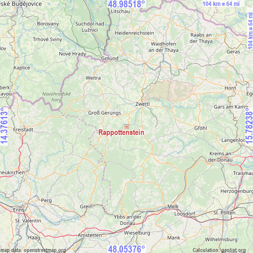
Rappottenstein GPS coordinates[2]
48° 31' 17.796" North, 15° 4' 45.3" East
| Map corner | latitude | longitude |
|---|---|---|
| Upper-left | 48.98518°, | 14.37613° |
| Center: | 48.52161°, | 15.07925° |
| Lower-right: | 48.05376°, | 15.78238° |
| Map W x H: | 103.6×103.6 km | = 64.4×64.4mi |
| max Lat: | 48.98333° ⇑5.2% North |
| Rappottenstein: | 48.52161° |
| min Lat: | ⇓94.8% South 46.48841° |
| min Long | Rappottenstein | max Long |
| 9.57802° | 15.07925° | 17.1° |
| W 55.5%⇐ | ⇒44.5% E |
Elevation
Elevation of Rappottenstein is 666 m = 2185 ft, and this is 160.5 m = 527 ft above average elevation for this country.
| Max E: |
2140 m = 7021 ft | 23.7% |
| Rappottenstein | 666 m 2185 ft | |
| Avg. | 505.5 m = 1658 ft | |
Min E: |
118 m = 387 ft | 76.3% |
See also: Austria elevation on elevation.city.
Geographical zone
Rappottenstein is located in North temperate zone (between Tropic of Cancer and the Arctic Circle). Distance of this North polar circle is 2006.1 km =1246.5 mi to North.| Distance of | km | miles | from Rappottenstein |
|---|---|---|---|
| North Pole | 4612 | 2865.8 | to North |
| Arctic Circle | 2006.1 | 1246.5 | to North |
| Tropic Cancer | 2789.2 | 1733.1 | to South |
| Equator | 5395.1 | 3352.4 | to South |


Nearby cities:
15 places around Rappottenstein: (largest is in red/bold)
• Altmelon
10.7 km =6.6 mi,  231°
231°
• Arbesbach
9.8 km =6.1 mi,  251°
251°
• Bad Traunstein
9.7 km =6 mi,  163°
163°
• Bärnkopf
15.6 km =9.7 mi,  200°
200°
• Grafenschlag
6.9 km =4.3 mi,  110°
110°
• Groß-Gerungs
10.7 km =6.6 mi,  303°
303°
• Langschlag
15.5 km =9.6 mi,  292°
292°
• Martinsberg
17.1 km =10.6 mi, 162°
• Ottenschlag
15 km =9.3 mi,  136°
136°
• Rudmanns
13 km =8.1 mi,  45°
45°
• Sallingberg
12.9 km =8 mi,  118°
118°
• Schweiggers
16.2 km =10.1 mi,  356°
356°
• Schönbach
8.7 km =5.4 mi, 203°
• Waldhausen
13.5 km =8.4 mi,  89°
89°
• Zwettl Stadt
11.5 km =7.1 mi,  34°
34°
Sources, notices
• [Note1] Compared only with cities in Austria existing in our database
• [Src1] Map data: © OpenStreetMap contributors (CC-BY-SA)
• [Src2] Other city data from geonames.org with taken over terms of usage.
• [Src3] Geographical zone / Annual Mean Temperature by Robert A. Rohde @ Wikipedia
